Risco Caído: the cave calendar of Gran Canaria and its sacred mountains
Risco Caído, Artenara, Gran Canaria//History/8 min read
In a cliff near Artenara, the ancient Canarians cut a cave that turns sunlight and moonlight into a calendar. You cannot go in, but a replica shows how it works.
 Written with by Eduardo Peire
Risco Caído is a group of caves carved by the ancient Canarians in a cliff near Artenara, in the mountains of Gran Canaria, and one of them works as a calendar: through a channel cut above its door, the sun and the full moon throw a patch of light that moves across a wall of engraved triangles as the seasons turn. Since 2019 it has given its name to a UNESCO World Heritage site, the Cultural Landscape of Risco Caído and the Sacred Mountains of Gran Canaria. The original cave is closed to visitors, and the way to see its light is a full-size replica in Artenara.
What is Risco Caído?
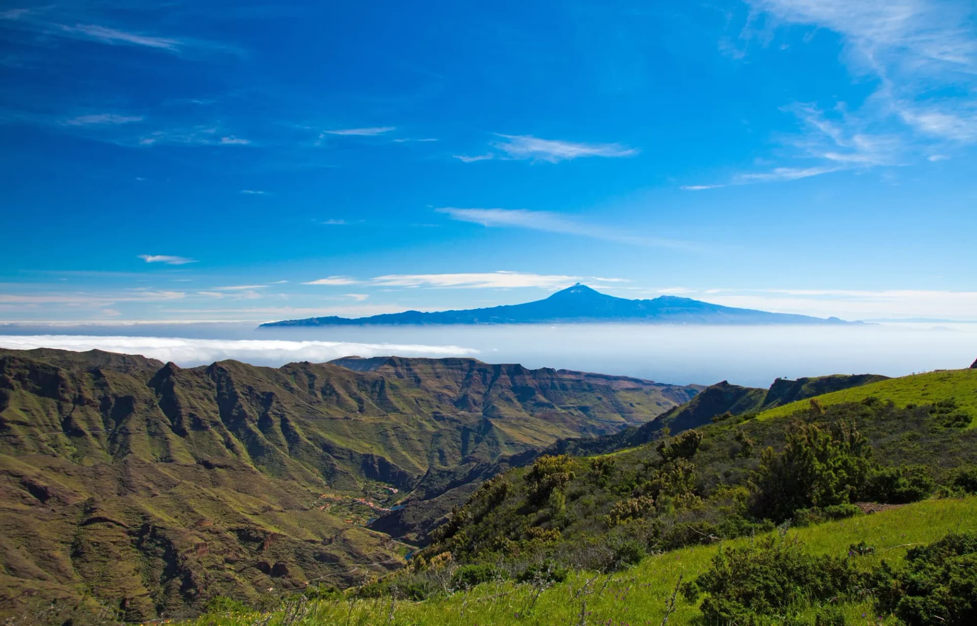
The UNESCO site covers 9,425 hectares of the centre of Gran Canaria, with a buffer zone of 8,557 more, inside the great volcanic basin of the Caldera de Tejeda. It was inscribed on the World Heritage List on 7 July 2019. In UNESCO's own description it is a landscape of cliffs and ravines full of cave dwellings, granaries and cisterns, left by a culture that grew up in isolation from the arrival of the first Berbers from North Africa, probably around the beginning of our era, until the Spanish conquest in the fifteenth century.
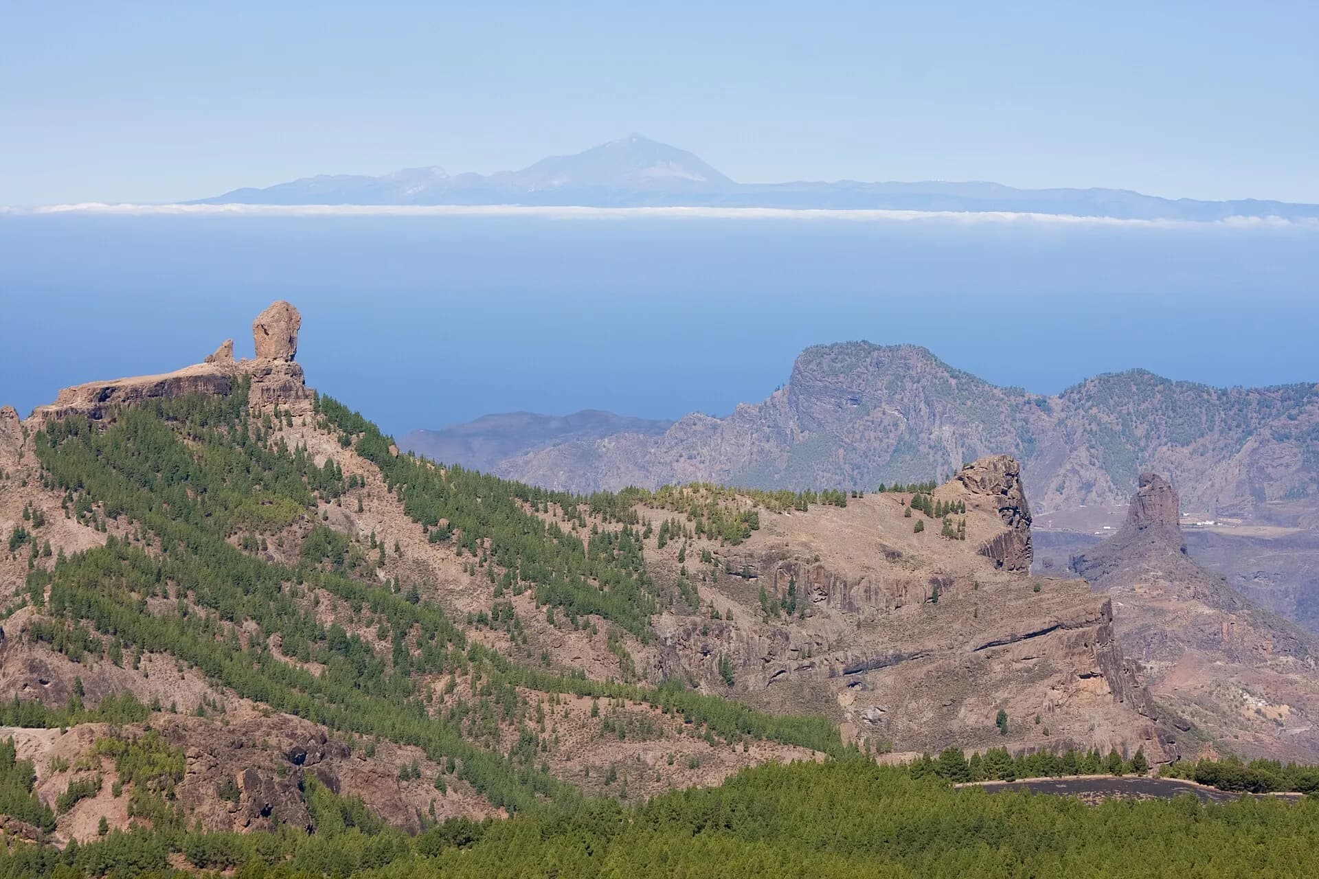
Two places in it are considered sacred temples, or almogarenes, where seasonal ceremonies were held: Risco Caído itself and the Roque Bentayga. UNESCO calls the whole area the final mountain refuge of the Imazighen, the Berber peoples, in the Canary Islands, and counts the night sky above it as part of what it protects. The Cabildo de Gran Canaria lists what this culture left across the landscape: caves painted inside, engraved pubic triangles and inscriptions in the Libyco-Berber alphabet, at sites such as Risco Caído, the Roque Bentayga and the Cueva de los Candiles.
The name is plain Spanish and means "fallen crag". Its aboriginal name, according to Artenara's official chronicler, was Artevigua.
How the light calendar of cave 6 works
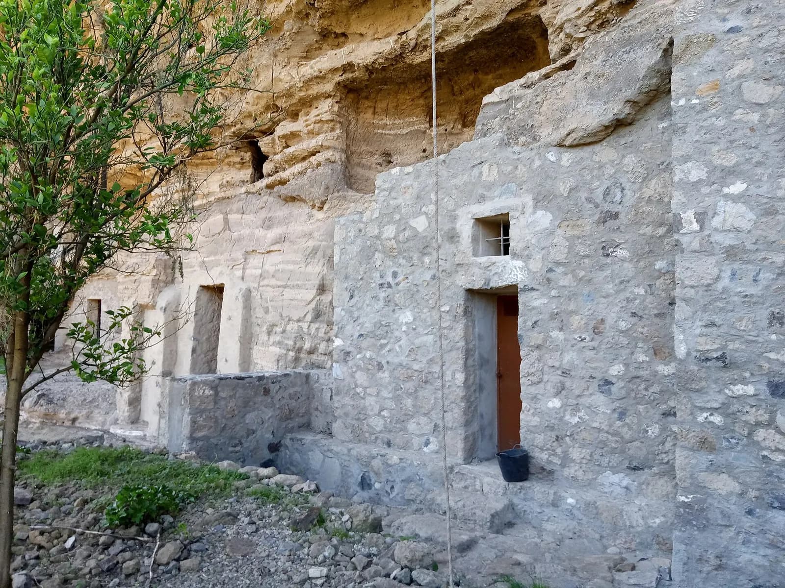
Risco Caído is a cluster of artificial caves on a cliff above the Barranco Hondo, the ravine that divides Artenara from Gáldar. The one that made it famous is known as cave 6. According to the Cabildo de Gran Canaria, the island government that manages the site, it is a chamber with a circular floor and a dome shaped like a paraboloid, and the regular pattern of its measurements and proportions stands out in a culture with such limited means.
Above the door, a channel cut through the rock lets light into the chamber. It falls on a wall carved with small bowls and with triangles in low relief that represent the female pubic triangle, the main symbol of the island's rock art. From the spring equinox to the autumn equinox, the sun projects shapes of light onto that wall, and they change shape and position as the days and months go by. From October to February the light that reaches the engravings is that of the full moon. The Cabildo reads the engravings as possible markers of a lunisolar calendar that told a farming people when to sow and when to harvest.
Who were the ancient Canarians?
The people who carved Risco Caído came from the Amazigh, or Berber, world of North Africa. UNESCO describes their culture as one that seems to have evolved in isolation for more than 1,500 years, until the Castilian conquest of Gran Canaria, which began in 1478, and calls it a unique case of an island culture with roots in the Amazigh world. Their homes were caves, natural or dug by hand, often to a cross-shaped plan, which the Cabildo reads as a sign of standard building methods.
They also built granaries in places almost nobody could reach. On the Mesa de Acusa, a flat-topped mountain inside the World Heritage site, the Álamo granary has two levels: the upper one, reached only by a hard climb up the cliff, is a chamber surrounded by twelve silos. Because it was so difficult to get to, part of what was stored there survived, and it tells archaeologists how these farmers managed their food. Acusa was no backwater: until the eighteenth century, the Cabildo notes, it had more inhabitants than Artenara, which is now the head of the municipality. More than two hundred terracotta idols, mostly female, have been documented on the island.
The triangle carvings at Risco Caído are not alone. The Cueva de los Candiles, in the Riscos de Chapín near Artenara, has walls completely covered in them. Like the light in cave 6, they are read as part of a religion of fertility for people who lived from the land and their flocks.
Roque Bentayga and the equinox sunrise
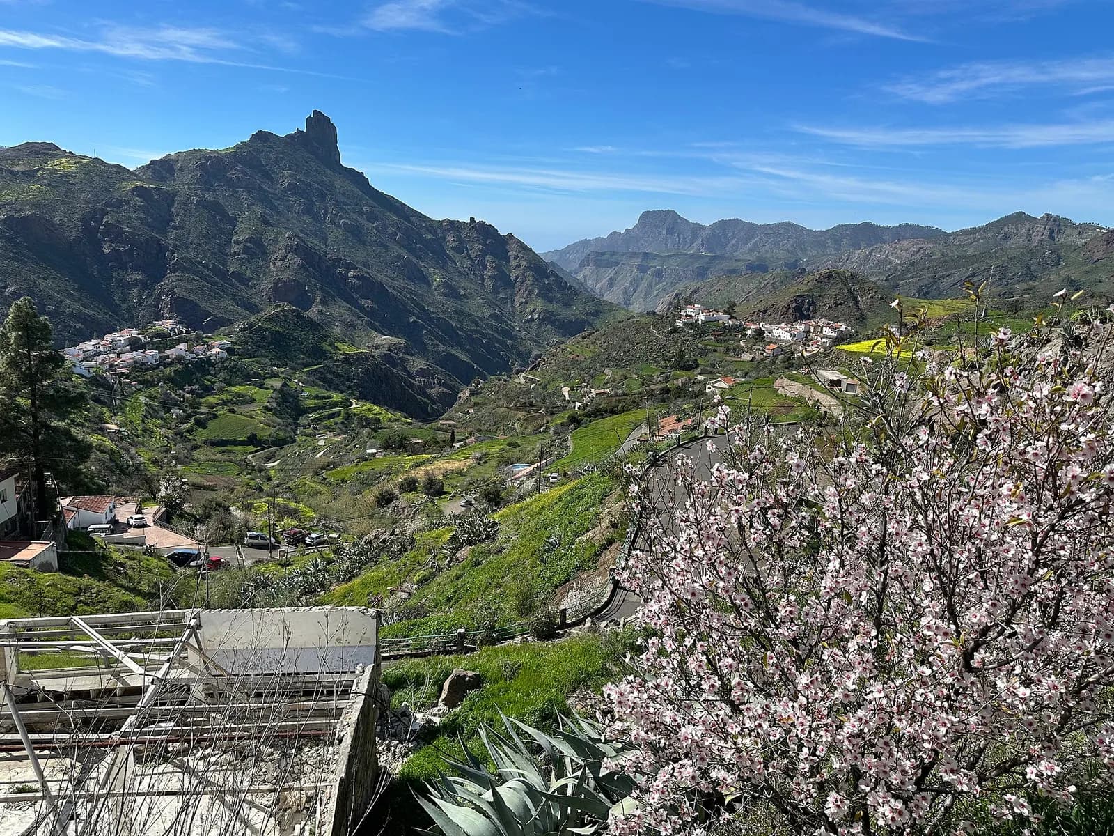
The second temple, the Roque Bentayga, is a rock tower standing in the middle of the Caldera de Tejeda. Its almogarén lines up with the Roque Nublo, the rock that crowns the centre of the island, and it marks the equinoxes. Shortly after sunrise on the equinox, the Cabildo explains, a slot carved in a rocky outcrop on the east side of the site casts a shadow onto a circular symbol about 70 centimetres across, engraved on the floor of the sanctuary.
The Bentayga interpretation centre, at the foot of the rock in Tejeda, runs free guided visits of about an hour, and a guided walk of half a kilometre, with 141 metres of climbing, goes up to the almogarén itself. It is the best place to understand how the whole basin was read as one sacred map, with the mountains marking where the sun would rise.
Artenara, where people still live in caves
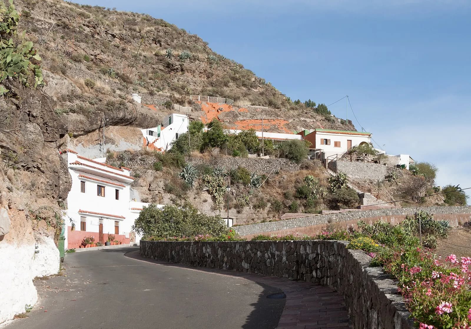
Risco Caído is not a ruin in an empty landscape, because the cave habit never ended. Artenara, the village above it, calls itself the village of cave houses, most of them dug into the cliffs, warmer in winter and cooler in summer. It became a municipality in 1734. Its chronicler tells the rest plainly: long droughts and hunger in the nineteenth century forced people to emigrate, and in the 1960s a farming crisis sent many down to the coast, where the tourist resorts were hiring.
Its chapel, the Ermita de la Virgen de la Cuevita, is a cave too: in the late nineteenth century it was enlarged inside the rock, and the altar, the choir, the pulpit and the confessional were carved from the same stone. The writer Miguel de Unamuno, who visited Gran Canaria twice, looked into the Caldera de Tejeda and wrote that it all seemed like "a petrified tempest, but a tempest of fire and lava", in the Cabildo's English version of his words. The viewpoint at Artenara is called the Balcón de Unamuno.
Some old trades survive here too. In Lugarejos, the pottery village of the area, the workshops are usually run by women and are traditionally caves. The clay is trodden with sand and water, shaped, smoothed, decorated with red ochre and fired in an open bonfire. The pots come out light, because for centuries they had to be carried long distances on foot, often on the head. Shepherds still move their flocks along ancient tracks: the Cabildo counts around 50 livestock farms in and around the site, with 3,150 sheep and 1,946 goats.
How to visit Risco Caído
The original cave 6 cannot be visited. UNESCO notes that the condition of the main sites has improved, mainly because the impact of tourism has been managed. What you can see is the Risco Caído interpretation centre in Artenara, itself dug into the hill. Its centrepiece, opened in June 2020, is a full-size replica of cave 6 in which a beam of light enters above the door and moves across the frieze of triangles, as the original does, marking the equinoxes and solstices. Guided visits last about an hour and are free; individuals book online, groups by email. The centres close on 1 and 6 January and on 25 and 31 December.
To see the real cliff, the Cabildo runs a guided walk from the La Poza neighbourhood of Barranco Hondo de Abajo down past Risco Caído and on to Lugarejos: 3.54 kilometres, about three and a half hours, medium difficulty. You look at the cave complex from the outside, which is as close as anyone gets, and finish in the potters' village.
Plan a full day for the summits and start early, because the mountain roads are narrow and slow. If you can, stay the night in Artenara or Tejeda: the dark sky UNESCO took the trouble to mention is the same one the light calendar was built for.
What the ancient Canarians ate
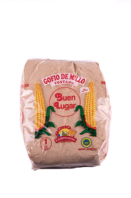
The granaries held the grain that fed this culture, and barley was one of its staples. The Cabildo notes that recent studies found the same variety of barley the ancient villagers sowed still growing here, adapted to the land. Part of the harvest became gofio, flour of toasted grain, which the island's tourist board describes as part of Canarian identity since pre-Hispanic times. Maize, an American crop, could only arrive after the conquest. Our guide to gofio tells the rest of that story.
In the north of the island, in Firgas, the Almeida family of Gofio Buen Lugar has milled gofio from maize since 1958. Only maize goes into their mill, and we sell their toasted maize gofio. It is not what the people of Risco Caído ate, but it comes from the same habit of toasting the grain before grinding it, and in Gran Canaria it is still on the breakfast table.
From Artenara the light at Risco Caído is a short walk away, and you will not see it. That is the arrangement, and the reason the triangles are still where they were left.
Questions
- Can you visit Risco Caído?
- Not the original cave. Cave 6 is closed, and visitors see a full-size replica in the Risco Caído interpretation centre in Artenara, opened in June 2020, where a beam of light moves across a copy of the frieze of triangles. Guided visits last about an hour and are free; individuals book online and groups by email. A guided walk of 3.54 kilometres from La Poza to Lugarejos passes the cliff but shows the caves only from outside.
- How does the light calendar of Risco Caído work?
- Cave 6 has a circular floor, a dome shaped like a paraboloid and a channel cut through the rock above the door. From the spring to the autumn equinox the sun projects shapes of light onto a wall engraved with pubic triangles and small bowls, and from October to February the light of the full moon does the same. The Cabildo de Gran Canaria reads it as a lunisolar calendar for sowing and harvest.
- When did Risco Caído become a UNESCO World Heritage site?
- The Cultural Landscape of Risco Caído and the Sacred Mountains of Gran Canaria was inscribed on the World Heritage List on 7 July 2019. It covers 9,425 hectares in the centre of the island, inside the Caldera de Tejeda, with a buffer zone of 8,557 hectares, and includes two sacred temples, Risco Caído and the Roque Bentayga.
- Who were the ancient Canarians of Gran Canaria?
- They came from the Berber, or Amazigh, peoples of North Africa and probably reached the island around the beginning of our era. UNESCO describes a culture that seems to have evolved in isolation for more than 1,500 years, until the Castilian conquest in the fifteenth century. They lived in natural and hand-dug caves, stored grain in cliff granaries such as the Álamo granary of Acusa, and left engraved triangles and Libyco-Berber inscriptions on the rock.
- What can you see at the Roque Bentayga?
- The Roque Bentayga, a rock tower in the middle of the Caldera de Tejeda, holds the second sacred temple of the World Heritage site, lined up with the Roque Nublo. Shortly after sunrise on the equinoxes, a slot cut in a rocky outcrop casts a shadow onto a circular symbol about 70 centimetres across engraved on the floor of the sanctuary. The interpretation centre at its foot runs free guided visits of about an hour, and a guided walk of half a kilometre, with 141 metres of climbing, goes up to the almogarén.
- How much time do you need for Artenara and Risco Caído?
- Plan a full day for the summits of Gran Canaria. The replica in Artenara takes about an hour, the guided walk from La Poza past Risco Caído to Lugarejos about three and a half hours, and the mountain roads are narrow and slow. UNESCO counts the night sky above the site as part of what it protects, so a night in Artenara or Tejeda is worth it.