How to climb Mount Teide: permits, routes and the Altavista refuge
Teide National Park, Tenerife//Activities/9 min read
The top of Spain is a volcano on an island where people sunbathe in January. Getting to its crater now takes a booking, a fee and respect for the altitude.
 Written with by Eduardo Peire
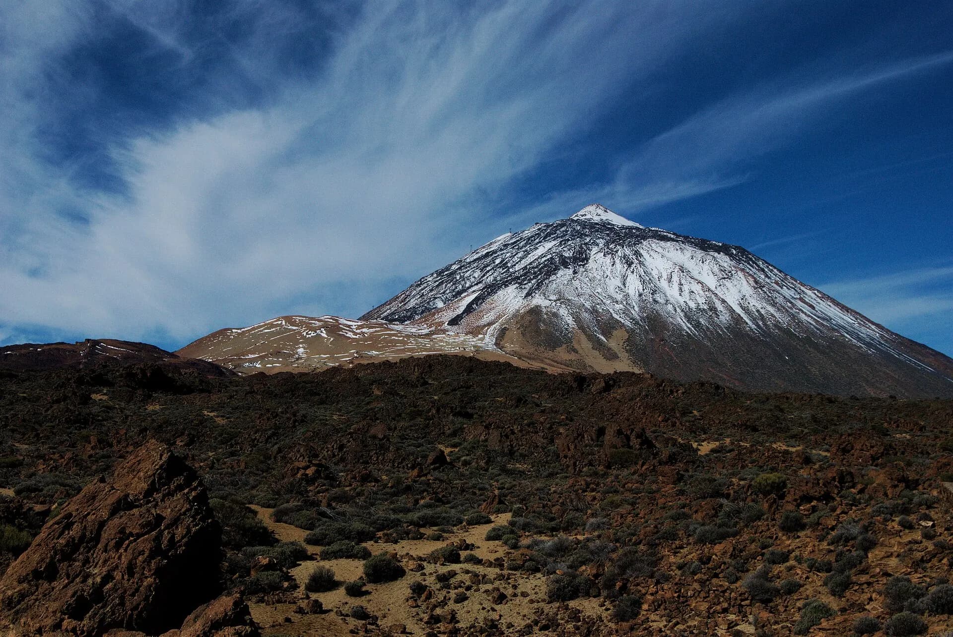
To climb Mount Teide, the highest peak in Spain, most people walk up from Montaña Blanca or ride the cable car to La Rambleta, a ledge about 160 metres below the top. The last stretch to the summit, the Telesforo Bravo trail, needs a permit booked on Tenerife ON, the booking platform of the Cabildo de Tenerife, and since January 2026 visitors from outside the island pay for the daytime slots. The old mountain refuge of Altavista, shut for years, reopened in July 2026, so the night climb to watch sunrise from the top is possible again.
Teide is a volcano, not a ski hill, and the rules on it change faster than the rock. The park's own website gives its height as 3,715 metres on its main page and 3,718 on its booking page. Either way, it is the top of Spain, and it sits on an island where people sunbathe in January.
What is Teide, and why does it matter
Teide stands in the middle of Tenerife, inside Teide National Park, created in 1954 and listed by UNESCO as World Heritage in 2007. UNESCO describes the Teide and Pico Viejo volcano as rising about 7,500 metres from the ocean floor, which makes it the third tallest volcanic structure in the world. From the beach you only see the top half.
The ancient Canarians, the Guanches, called the mountain Echeyde, the home of Guayota, the evil one. According to the legend retold by the national park, Guayota kidnapped the sun god Magec and hid him inside the volcano, until the supreme god Achamán freed the sun and plugged the crater. The plug is said to be the Pan de Azúcar, the sugarloaf cone you climb at the very end.
The volcano has not been quiet in written history. Fernando Colón, son of Christopher Columbus, wrote that when his father's ships passed Tenerife on 24 August 1492, on their way to La Gomera, the crews saw great flames coming from the highest mountain of the islands. In 1798 an eruption on the slopes of Pico Viejo, the neighbouring summit, lasted 99 days and opened the row of craters called the Narices del Teide, Teide's nostrils. Near the summit crater, small fumaroles still steam today.
The astronomer who slept on the volcano
Teide's best-known early visitors were scientists. Alexander von Humboldt studied its plants in June 1799. In 1856 Charles Piazzi Smyth, Astronomer Royal for Scotland, sailed to Tenerife with the backing of the Admiralty to test an idea that went back to Newton: that a telescope would see better above the clouds. He camped first on Guajara, on the rim of the old crater, and then at Altavista, high on Teide itself, with his wife, who in the words of Scientific American was the best assistant an astronomer ever had. The magazine reported in 1858 that he had proved Newton right: a telescope sees further in high, dry air. His book about the trip, Teneriffe, an Astronomer's Experiment, is credited as the first book ever illustrated with stereoscopic photographs.
Tenerife never forgot it. The first permanent building at Altavista went up in 1892. For years it was the highest post office in Spain, its supplies came up by mule for decades, and its visitors' book starts in 1929. East of the caldera, the Teide Observatory at Izaña, at 2,390 metres, took its first telescope in 1964 and became, in 1979, the birthplace of helioseismology, the study of the inside of the sun through its vibrations. The park has carried a Starlight certification for its night sky since 2013.
How to climb Mount Teide on foot from Montaña Blanca
The classic way up is trail number 7, Montaña Blanca to La Rambleta. According to the national park's trail guide, it starts at kilometre 40.2 of the TF-21 road, runs 8.2 kilometres, climbs 1,186 metres and takes about five and a half hours to La Rambleta, at 3,537 metres. The park rates it as hard, warns that the slope in places is steeper than 60%, and advises against it for anyone with heart problems.
The first part follows a dirt track across pale pumice from the eruptions of Montaña Blanca. At the foot of Teide lie the huevos del Teide, the eggs of Teide: giant balls of lava that came out of the crater and rolled all the way down the slope. Then the old path to the summit starts to zigzag up through the broom. At around 3,400 metres plants seem to stop. They do not quite: the Teide violet, Viola cheiranthifolia, flowers above 2,500 metres and almost up to the summit, one of the very few plants in Spain that grows above 3,000 metres.
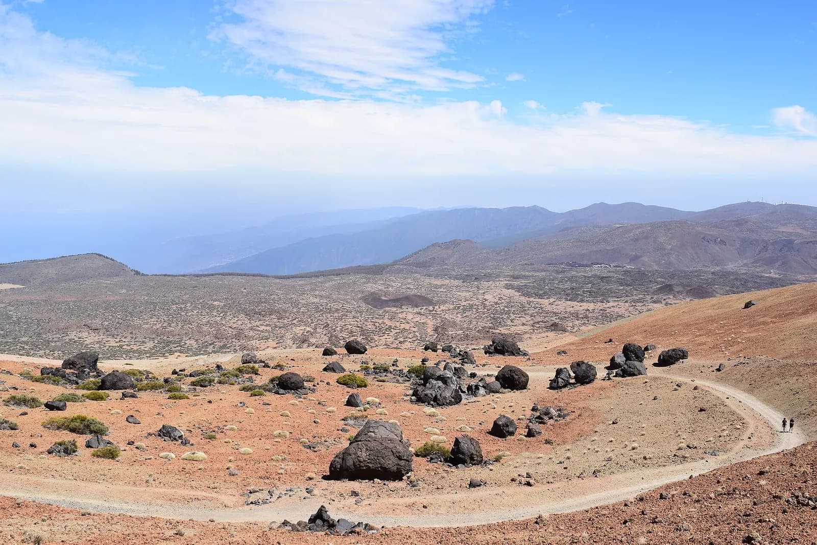
This trail is also booked on Tenerife ON, and since 19 January 2026 the daytime starts carry a fee: 6 euros on weekdays and 10 euros at weekends and on holidays for people from outside the Canary Islands, 3 and 5 euros for other Canarians, and nothing for residents of Tenerife.
Sleeping at the Altavista refuge
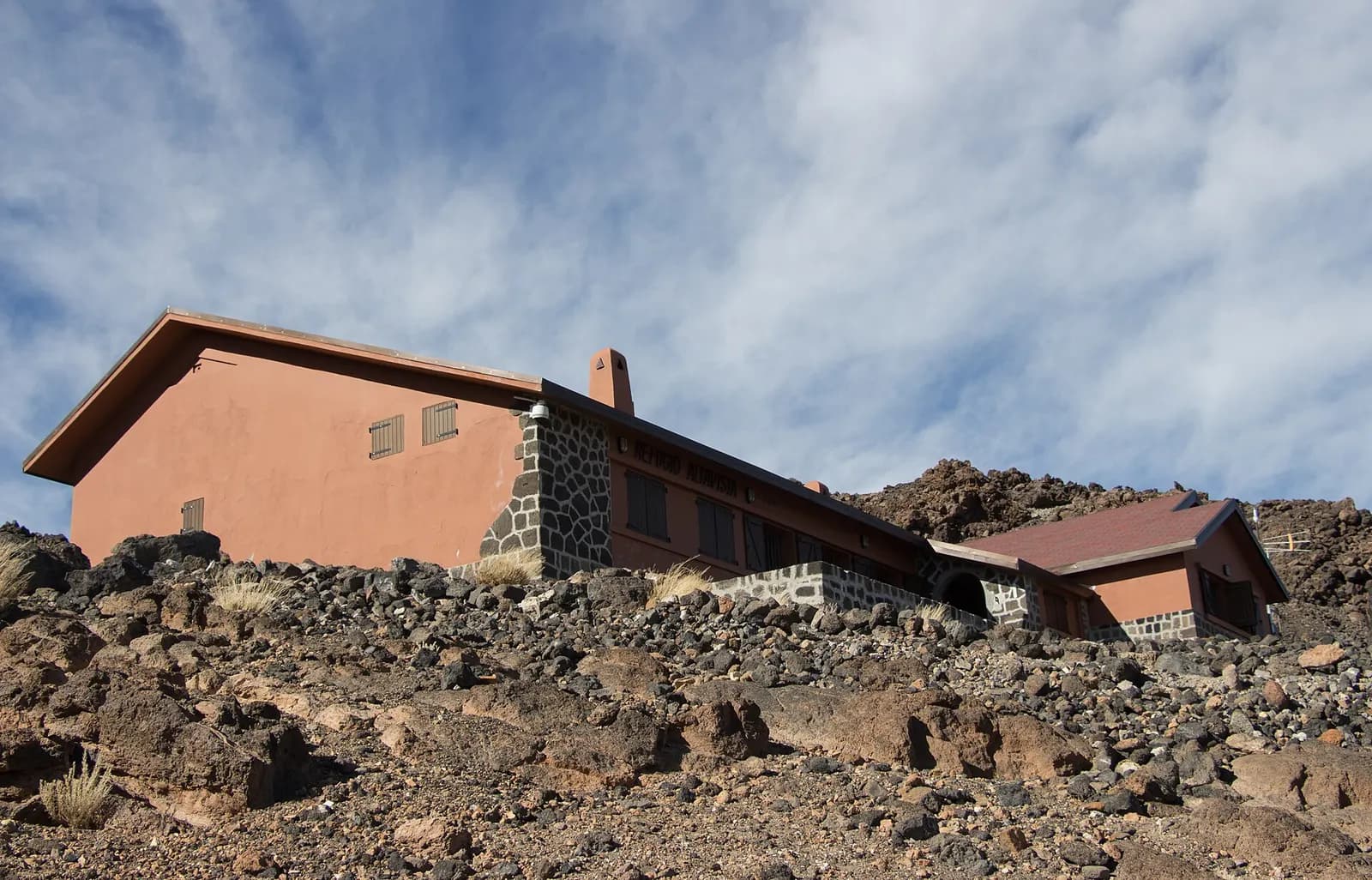
Halfway up the steep part, at 3,260 metres, stands the Altavista refuge. It reopened in July 2026, after years shut, following a renovation that the Cabildo put at 1.9 million euros, with solar power and its own wastewater plant. It sleeps 49 walkers, with two places for wardens and a small first aid room, and the new rules allow one night per person. At the reopening a night cost 71 euros, 56.80 euros for federated mountaineers and 29 euros for residents of Tenerife.
The point of sleeping there is the dark. You leave the refuge in the small hours, walk the last section by headtorch and reach the summit for sunrise, when the shadow of Teide falls as a long triangle across the sea of clouds to the west. In October 2026 the Cabildo added dawn slots on the summit trail, for refuge guests and for those who walk up in the dark, and they too are booked in advance.
The summit permit for the Telesforo Bravo trail
The last stretch is trail number 10, named after Telesforo Bravo, the Canarian geologist many regard as the father of volcanology in the islands. It runs about 650 metres from La Rambleta to the summit and climbs 168 metres, which on a map looks like a stroll and at 3,600 metres does not feel like one. The park suggests 40 minutes and frequent stops to catch your breath.
Access is strictly limited. The park's booking page explains the system: permits are booked on the trail's page on Tenerife ON, up to 56 days ahead, with a new week released every Monday at 07:00 Canary time, and each person may book only once every 15 days. A cable car ticket is not a permit, and the permit does not depend on the cable car running. Carry it with a passport or ID card, because wardens check. Whoever books and neither turns up nor cancels can be barred from booking for three months.
Since 19 January 2026 the permit costs 15 euros for visitors from outside the Canary Islands and 6 euros for residents of the other islands, in the slots that match the cable car's hours; it is free for residents of Tenerife and for children, and the trail page charges nothing for slots outside those hours. The money comes back only if the trail closes, if the cable car does not run, or if you cancel at least three days ahead. In October 2026 the Cabildo shortened each summit slot from two hours to 90 minutes, and walking a booked trail without a permit can now be fined up to 600 euros. The rules changed twice in 2026, so check the trail page before you plan anything around them.
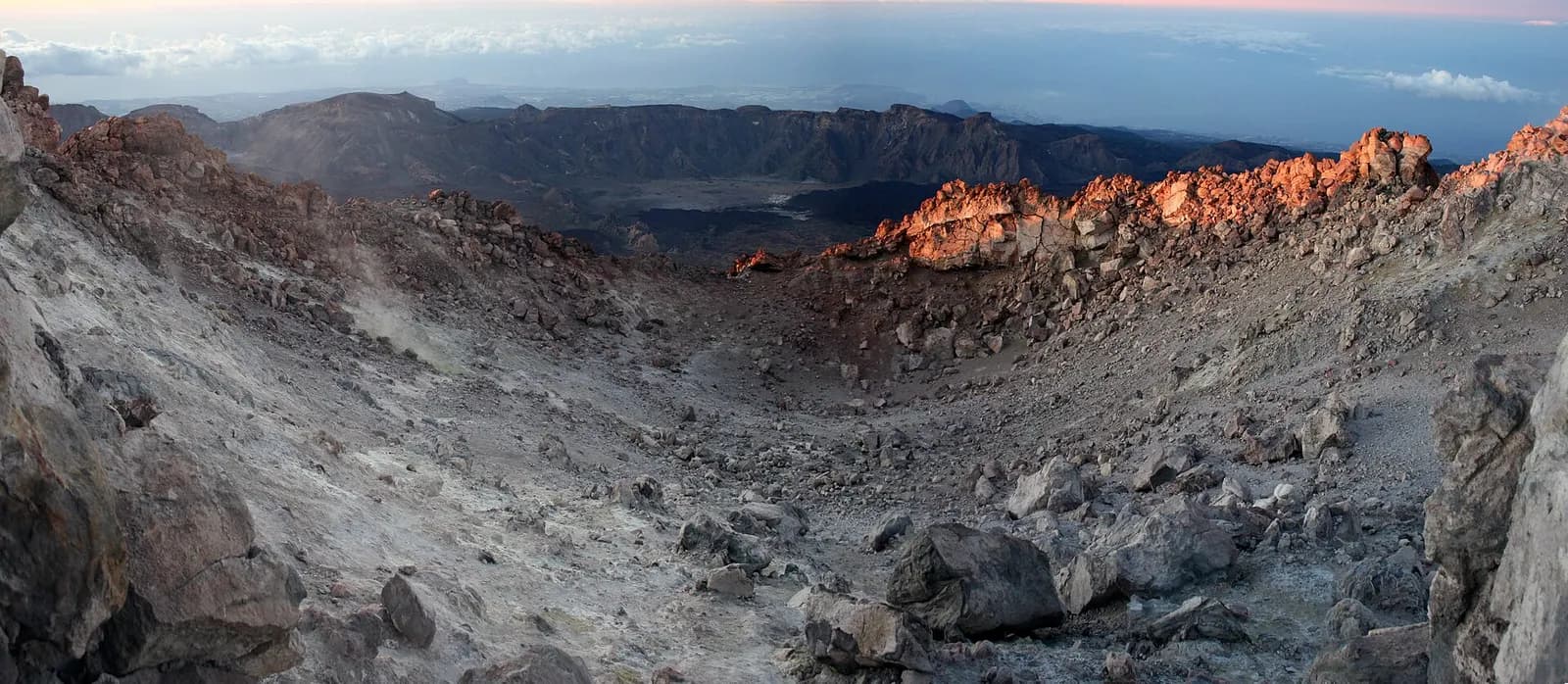
The trail ends at the rim. Walking into the crater or around it is forbidden, and so is staying on the trail outside your slot.
Altitude, ice and the volcano underneath
Teide is high enough for altitude sickness, and the cable car lifts people to La Rambleta far faster than their bodies can adjust. Headaches, nausea and breathlessness are the usual signs, and the park says the summit trail is not for people with heart, breathing or mobility problems.
Winter is the real hazard. Snow and ice can close the upper trails for days. Even in good weather the summit permit asks for mountain boots, long trousers and warm clothes, and when there is ice or snow it also asks for crampons, an ice axe and a signed statement of mountaineering experience. Wardens turn back anyone without the required gear, and the fee is not refunded. When a storm whitens the mountain, the whole island drives up to see it: after the snowfall of storm Emilia in December 2025, the Cabildo restricted car access to the park for a weekend and carried 5,536 people up in shuttle buses instead, keeping an estimated 1,845 cars out.
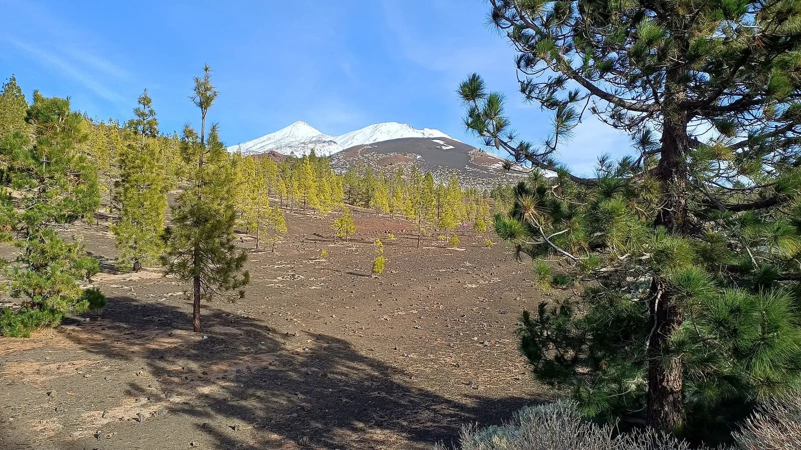
And the mountain is not asleep. Since February 2026 scientists have recorded unusual swarms of small earthquakes under Las Cañadas, none of them felt by people. In August 2026 the Canary Islands volcanic emergency committee, PEVOLCA, said that light earthquakes that people could feel might occur around Las Cañadas, saw no signs of an eruption in the coming weeks or months, and left the island's volcanic alert unchanged. It is a good reason to check the news, not a reason to stay at home.
Crowds, new rules and what is left to find
In 2025 Teide National Park received 5,113,021 visitors, according to the national parks network, more than any other national park in Spain and more than twice as many as the next one, Sierra de Guadarrama. That pressure has brought rules. In December 2025 the Canary Islands government approved the park's management plan after 23 years of waiting. The Cabildo de Tenerife, which has since taken over the full management of the park, plans access controls at the park entrances, 500 parking spaces to be booked in advance and, from 2027, shuttle buses from four points of the island, with the aim of cutting the pressure on the park by up to half. Some of that is still a plan. Check what is in force when you go.
For those who want more than the summit, the hard way still exists. A long waymarked route, the PR TF 41, starts at Playa del Socorro on the north coast and climbs from sea level all the way to the summit, and it needs both permits for its last stretches. From La Rambleta a rough path drops past the crater of Pico Viejo to the Narices del Teide, rated extreme by the park. Since October 2026 it needs a free booking too, shared with two other trails within a limit of 225 walkers a day, and walkers must carry boots, long trousers, warm clothes, hat and gloves, water, a charged phone, a survival blanket and a headtorch even when the weather is fine. The Teide edelweiss, Gnaphalium teydeum, grows only around the warm, damp fumaroles near the summit. Look for it from the path, which is as close as anyone may go.
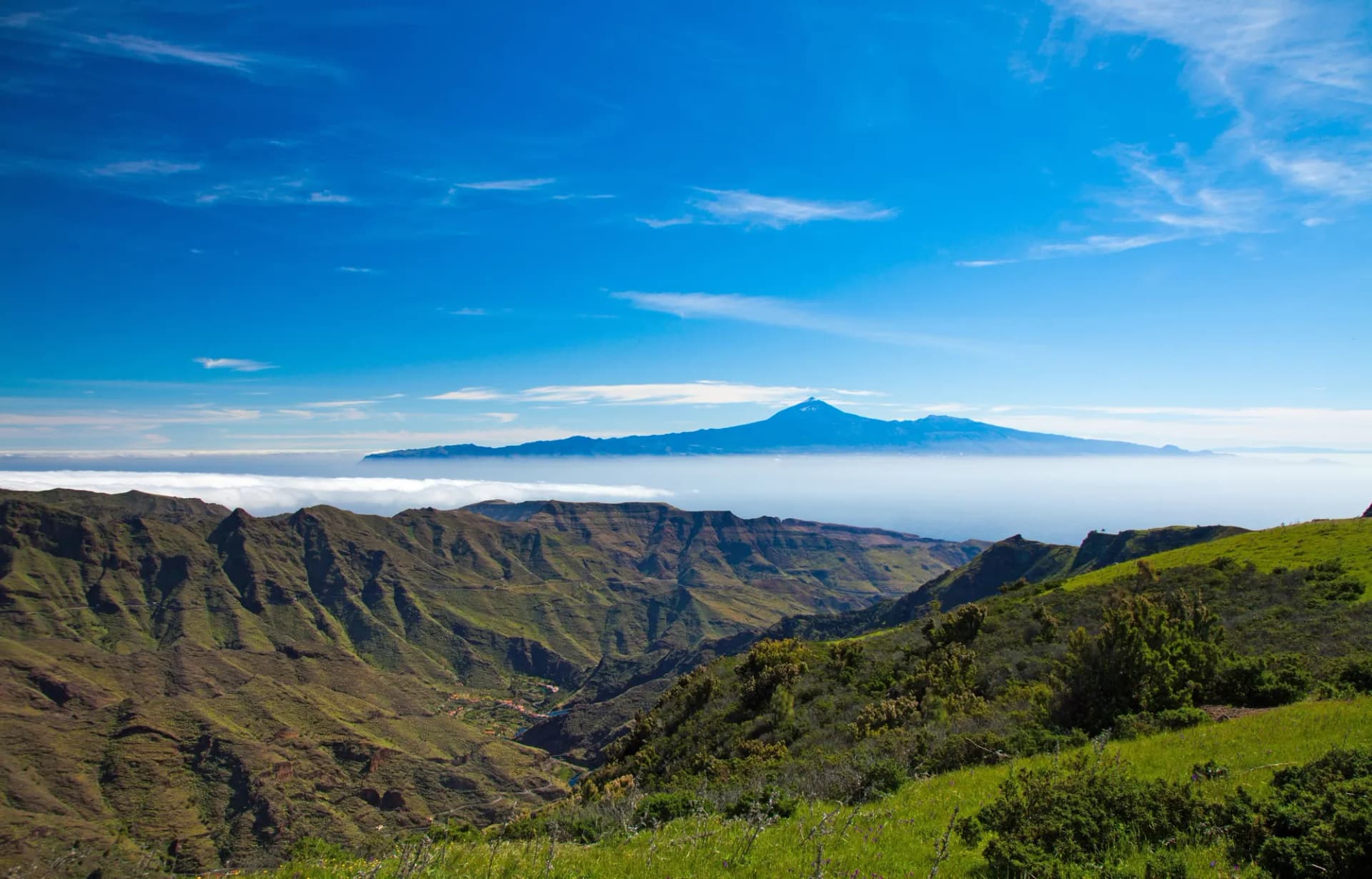
Afterwards, go down to the north of the island, where the wine is. If the climb falls at the end of November, it falls on San Andrés and the new wine of Tenerife. The island's other faces are in our guide to Tenerife, and the view the other way, Teide floating on cloud at sunrise, belongs to the walkers on the summit of La Gomera, in Garajonay.
A night at Altavista once cost five pesetas. Now it costs 71 euros, and the last 168 metres of Spain need a booking that opens on Mondays at seven.
Questions
- Do you need a permit to climb Mount Teide?
- Yes, for the last stretch. The Telesforo Bravo trail from La Rambleta to the summit of Mount Teide needs a permit booked on Tenerife ON, the Cabildo de Tenerife's platform, up to 56 days ahead, and each person can book it once every 15 days. The Montaña Blanca and Pico Viejo trails are booked there too. A cable car ticket is not a permit.
- How much does it cost to climb Teide in 2026?
- Since 19 January 2026 the Teide summit permit costs 15 euros for visitors from outside the Canary Islands and 6 euros for residents of the other islands, in the slots that match the cable car's hours. It is free for residents of Tenerife and for children. The Montaña Blanca trail costs non-residents 6 euros on weekdays and 10 euros at weekends; current prices are on each trail's page on Tenerife ON.
- How long does it take to climb Mount Teide on foot?
- The national park gives about five and a half hours for the Montaña Blanca trail, 8.2 kilometres with 1,186 metres of climbing, from the TF-21 road to La Rambleta. The final summit trail of Teide adds about 650 metres and 168 metres of climbing, which the park puts at 40 minutes.
- Can you sleep on Mount Teide?
- Yes, at the Altavista refuge, at 3,260 metres on the Montaña Blanca route up Teide. It reopened in July 2026 after a renovation, sleeps 49 walkers and allows one night per person; at the reopening a night cost 71 euros, or 29 euros for residents of Tenerife. Elsewhere in the national park, sleeping out is allowed only in its bivouac areas, with an authorisation from Tenerife ON.
- Can you climb Teide in winter?
- Often, but not always. Snow and ice can close the upper trails of Teide, and when there is ice the summit permit requires crampons, an ice axe and a signed statement of mountaineering experience. After heavy snowfalls the Cabildo de Tenerife has restricted car access to the park and run shuttle buses instead.
- Is altitude sickness a problem on Teide?
- It can be. The cable car lifts people to La Rambleta, above 3,500 metres, very quickly, and headaches, nausea and breathlessness are common near the summit of Teide. The national park says the summit trail is not suitable for people with heart, breathing or mobility problems.