La Palma volcano today: what you can see since the Tajogaite eruption
Tajogaite, El Paso, La Palma//Activities/8 min read
Five years after the 2021 eruption, a road crosses the lava, the coast has 48 new hectares and Puerto Naos is open again. What visitors can do now, and what they cannot.
 Written with by Eduardo Peire
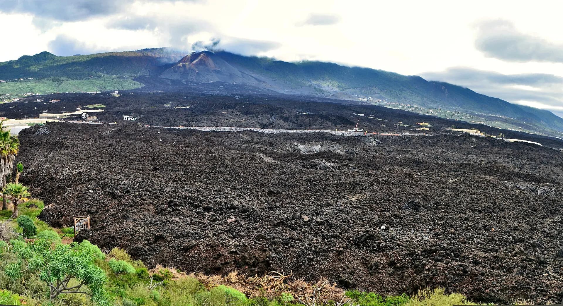
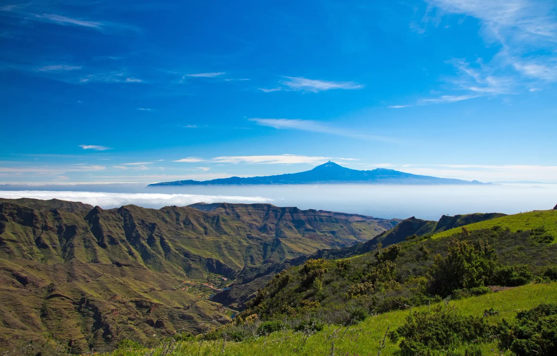
The La Palma volcano, officially called Tajogaite since 2024, erupted on the western slope of the Cumbre Vieja ridge from 19 September to 13 December 2021 and buried a large part of the Aridane valley under new rock. You can visit it today, but only on a guided walk with a company authorised by the island government, which takes you to within a few hundred metres of the cone. The rest of La Palma, from the Caldera de Taburiente to the telescopes on the summit, is open as before, and the west of the island is rebuilding partly on what visitors spend there.
What the eruption changed
The first vent opened at 14:10 UTC on 19 September 2021 at Cabeza de Vaca, in the municipality of El Paso. The Canary Islands volcanic emergency plan later dated the end to 22:21 UTC on 13 December, after 85 days and 8 hours, according to the Instituto Geográfico Nacional, Spain's national geographic institute. The European Union's Copernicus satellite service put the final toll at 1,241 hectares covered by lava, 2,988 buildings destroyed and 92 kilometres of road lost. Copernicus translated the area into about 1,500 football pitches. On the ground it meant houses, banana plantations, irrigation ponds and the lanes between them.
The lava did not only take land. Where it poured over the cliffs below Tazacorte it kept going into the Atlantic and built two fajanas, flat platforms of fresh rock at the foot of the old coastline. Together they add up to about 48 hectares, the newest ground on the island. Legally they count as coast, not as replacement farmland for the people who lost theirs upslope, and nothing is built on them without the say of Spain's coastal authority. In July 2024 the ecological transition ministry raised its proposed fine against the island's own water board to 2,132,760 euros, for laying an irrigation pipe almost 1,500 metres long across the Fajana Grande without permission. The pipe carries water to the banana farms of Las Hoyas and El Remo, further south, which is why nobody was keen to pull it out.
By June 2026 the Cabildo, the island government, was drafting a plan with the state and Canarian coastal authorities to decide what the fajanas are for. The draft talks about opening some of the new coves for bathing, burying the pipe and narrowing the road, which has to stay for safety. Plocan, the Canary Islands' ocean science platform, reported that the water around the new land is back to normal values and that sea life is moving in faster than expected.
Why the volcano is called Tajogaite
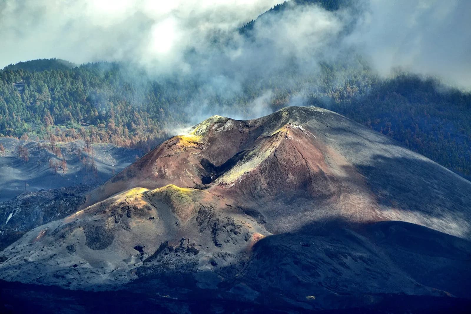
For more than two years the new mountain had no official name, although scientific papers, road signs and tourist leaflets all needed one. In June 2022 the Cabildo opened a public consultation with ten proposals. "Volcán de Tajogaite" won 35.6 per cent of the support, ahead of "Tagojaite" with 22.1 per cent, which is the same word with two letters swapped, and "Volcán de Cumbre Vieja" with 15.9 per cent. The island council approved the name unanimously on 9 February 2024, as RTVC reported. Tajogaite is the old place name of the hollow where the vents opened, the Hoya de Tajogaite.
Puerto Naos, the village kept shut by gas
Once the lava cooled, the worst problem on the coast was invisible. Volcanic carbon dioxide seeped up through the ground at Puerto Naos and La Bombilla, the two seaside villages of the Aridane valley, and collected in ground floors and garages. The houses were standing; the air in them was not safe. Returns have been authorised house by house since then, each one after the gas readings allowed it.
By April 2026 the Cabildo had cleared 1,163 homes in Puerto Naos and 58 in La Bombilla, plus 42 businesses, and its president said both villages were safe to visit. A month later the two places had more than 1,500 sensors and 220 outdoor gauges reading the gas around the clock. In July 2026 the island council allowed bathing again at Playa Chica, the small beach of Puerto Naos, after the carbon dioxide levels dropped. In this corner of the island, a swim still makes the regional news.
Can you visit the La Palma volcano?
Yes, with a guide. The cone sits inside the Cumbre Vieja Natural Park and the area around it is restricted. The official tourism site of the Canary Islands describes a circular walk of about 6 kilometres, easy to moderate, that can only be done with authorised guides booked through a licensed company on La Palma. A Forbes España report from 2024 described a version of about 5 kilometres there and back, two and a half hours long, that gets to within some 300 metres of the cone, the closest point open to anyone. The path crosses ash and broken lava with little shelter from sun or wind.
Without a guide there is still plenty to see. From Tajuya, on the edge of El Paso, you look across the lava field to the cone. Boat trips from the port of Tazacorte go along the coast to show the fajanas from the sea, which is the only way to see how far the new land sticks out.
Walking the Ruta de los Volcanes
Tajogaite is the latest of a long line. The Cumbre Vieja ridge is a chain of cones and craters that runs down the south of the island, and the classic way to understand it is on foot. The Ruta de los Volcanes runs for 17.5 kilometres from the El Pilar refuge to Los Canarios, in Fuencaliente, with 1,207 metres of climbing, a high point of 1,932 metres and a difficulty rating of high. The island's tourism site advises six to eight hours. On the way it passes Hoyo Negro, one of the vents of the San Juan eruption of 1949, and the cones of El Duraznero and Las Deseadas, before dropping towards the volcano of Martín, which erupted in 1646.
The route closed during the 2021 eruption and reopened in May 2022. It is one way, so you need a taxi or a second car at the end, and the ridge is often windy and cold even when the coast is in shorts. Check the island's trail status before you go: after storms or fires, sections can close.
The Caldera de Taburiente and the sky above it
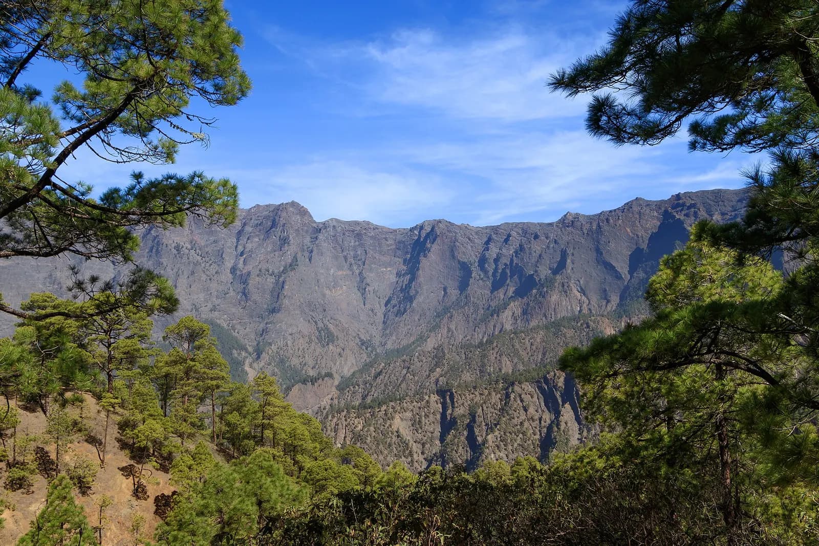
The north of La Palma was never touched by the eruption. Its centre is the Caldera de Taburiente National Park, a cirque 8 kilometres across with drops of almost 2,000 metres, according to Spain's national parks service. A road climbs from the park's visitor centre near El Paso to the La Cumbrecita viewpoint on the rim; check the park's website for access before you drive up.
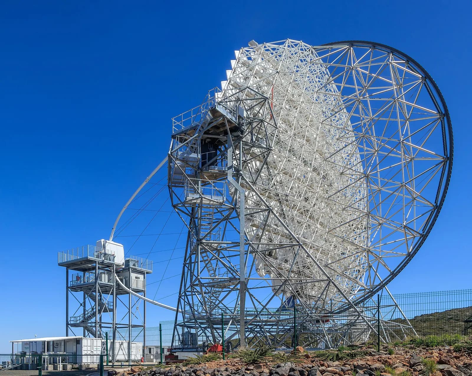
On the rim of the Caldera stands the Roque de los Muchachos Observatory. La Palma's night sky has been protected since 1988, when the Spanish parliament passed the Ley del Cielo, the Sky Law, to keep the island's observatories dark enough to work. In October 2026 Spain's science ministry reported that the four Large-Sized Telescopes of the Cherenkov Telescope Array Observatory now stand on the summit, three of them new and still being commissioned. Each has a mirror 23 metres across, and together they catch the faint bluish flashes produced when very high energy gamma rays hit the atmosphere. When the observatory is complete it will have more than 60 telescopes between La Palma and Paranal, in Chile.
The volcano is also changing what the island does for a living. In December 2025 La Palma, the only candidate, was chosen as the seat of Spain's new National Volcanology Centre. Two sites were put forward, one of them in El Paso, next to the area hit by the eruption. The island that had to learn volcanology the hard way will now host the people who study it.
Does going help?
It does, in a plain economic sense. La Palma received 297,399 tourists in 2025, 18.4 per cent more than the year before, according to a report on the island's economy by the Tenerife Chamber of Commerce, but still fewer than before the pandemic. Cruise ships brought a record 363,325 passengers the same year. A cruise passenger spends a few hours ashore; the guesthouses, guides, restaurants and shops of the Aridane valley live on the people who sleep there.
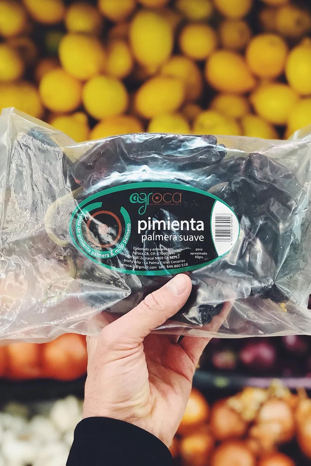
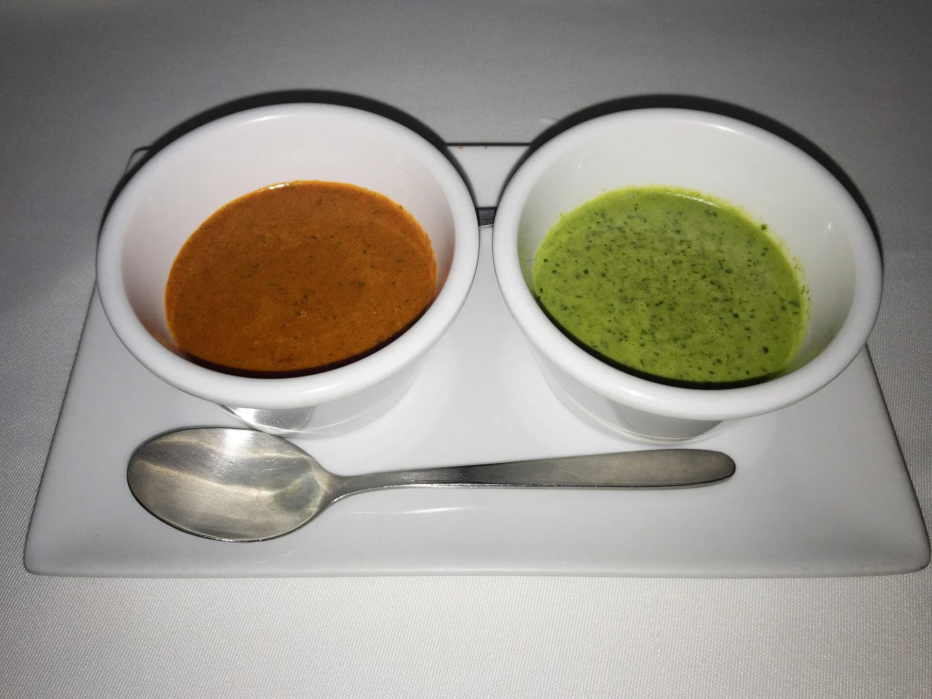
What you eat helps too. On the east side of the island, in Breña Alta, Mojos Regina grows its own palmera pepper, the local pepper of La Palma's mojo, from its own seed, picks it by hand as each one ripens and dries it. We sell their dried palmera pepper, for anyone who wants to make the sauce at home; our guide to Canarian mojo explains how.
When to go and how to plan it
La Palma has no busy season in the way Tenerife does, and that is part of the point. Winter and spring are the best months for walking, when the ridge is cooler than in summer. For the volcano walk, book a few days ahead, wear boots with a stiff sole for the lava and carry a layer for the wind. Stay on the marked paths: the lava fields are protected, and much of the flow covers land that belonged to someone.
For the stars, the summit road is the place, on a night without a moon. For a smaller and windier island further south, read about El Hierro and its renewable energy. For the eruption itself, the valley is enough: drive the new road across the lava and look at what has started to grow on top of it. Down on the coast the pipe across the fajana is still there, and so are the banana farms it waters.
Questions
- Can you visit the La Palma volcano?
- Yes, but only on a guided walk. The Tajogaite cone lies in a restricted area of the Cumbre Vieja Natural Park, and the official Canary Islands tourism site describes a circular route of about 6 kilometres that can only be done with authorised guides from a licensed company on La Palma; it gets to within about 300 metres of the cone. Without a guide, Tajuya, in El Paso, looks across the lava field, and boat trips from Tazacorte show the new coast.
- When did the La Palma volcano erupt and for how long?
- The eruption began at 14:10 UTC on 19 September 2021 at Cabeza de Vaca, in El Paso, and the Canary volcanic emergency plan dated its end to 13 December 2021, after 85 days and 8 hours, according to Spain's Instituto Geográfico Nacional. The Copernicus satellite service counted 1,241 hectares covered by lava, 2,988 buildings destroyed and 92 kilometres of road lost.
- Why is the La Palma volcano called Tajogaite?
- Tajogaite is the old place name of the hollow where the vents opened, the Hoya de Tajogaite. The name won a public consultation run by the Cabildo de La Palma in June 2022 with 35.6 per cent of the support, ahead of Tagojaite and Volcán de Cumbre Vieja, and the island council approved it unanimously on 9 February 2024.
- Is Puerto Naos open again after the eruption?
- Yes. Volcanic carbon dioxide kept Puerto Naos and La Bombilla closed long after the lava stopped, and returns have been authorised house by house as the gas readings allowed. By April 2026 the Cabildo de La Palma had cleared 1,163 homes in Puerto Naos, 58 in La Bombilla and 42 businesses and called both villages safe to visit. More than 1,500 sensors watch the air, and bathing at Playa Chica was allowed again in July 2026.
- Is the Ruta de los Volcanes open after the eruption?
- Yes. The Ruta de los Volcanes closed during the 2021 eruption and reopened in May 2022. It runs one way for 17.5 kilometres from the El Pilar refuge to Los Canarios, in Fuencaliente, with 1,207 metres of climbing and a high point of 1,932 metres. La Palma's tourism site advises six to eight hours; arrange transport at the end and check the trail status before setting out.
- What else is there to see on La Palma?
- The north of La Palma was untouched by the eruption. The Caldera de Taburiente National Park is a cirque 8 kilometres across with drops of almost 2,000 metres, with a viewpoint on the rim at La Cumbrecita. Above it stands the Roque de los Muchachos Observatory, where the four Large-Sized Telescopes of the Cherenkov Telescope Array Observatory now stand, under a sky protected by law since 1988.