Walking in Garajonay: La Gomera's laurel forest, its fog and its trails
Garajonay National Park, La Gomera//Activities/9 min read
A forest left over from the Tertiary, kept alive by fog, spared in part by the old lords of the island and burnt in 2012. How to walk it, and the rules that protect it.
 Written with by Eduardo Peire
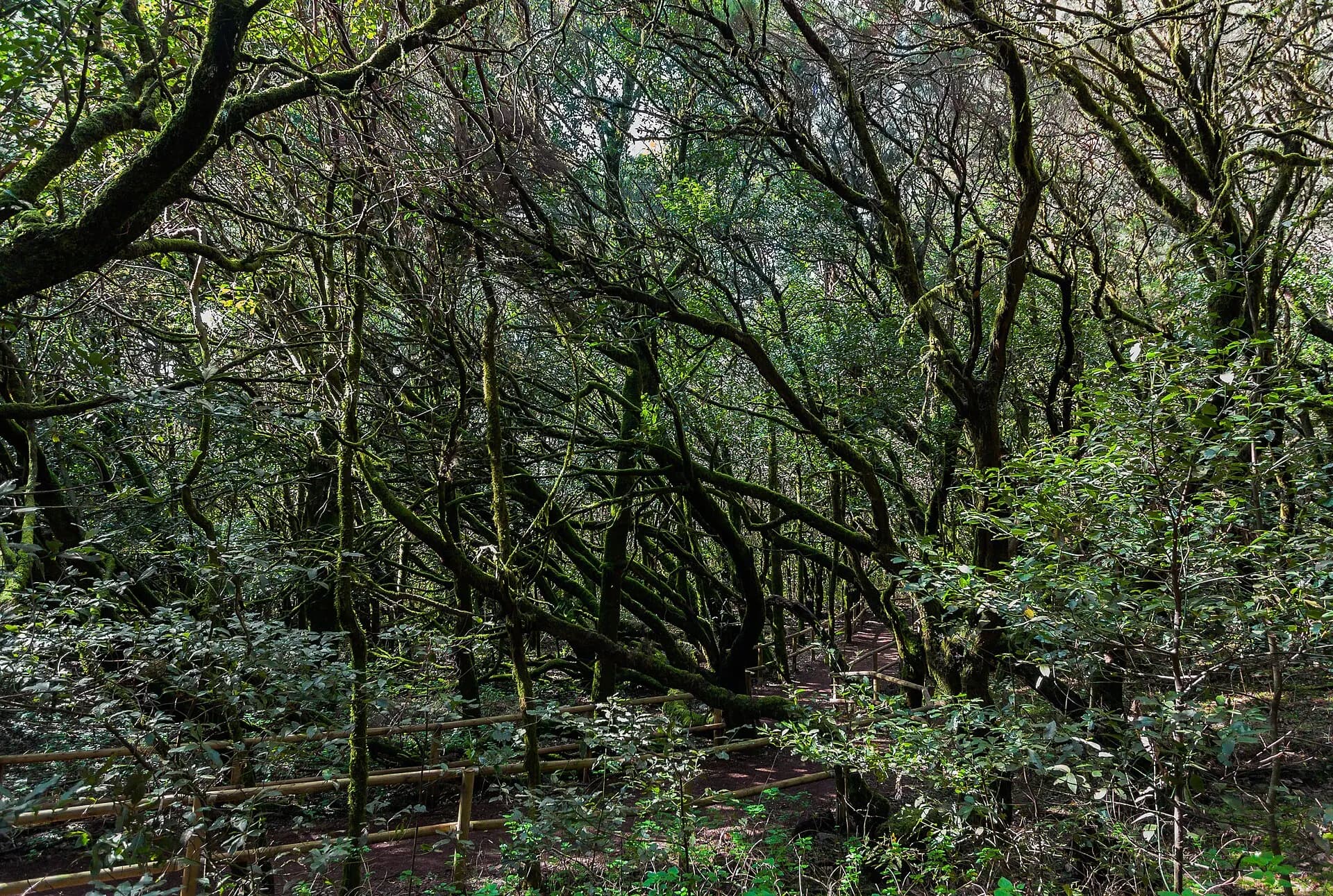
Walking in Garajonay, the national park at the top of La Gomera, usually means walking inside a cloud. The trade wind pushes wet air up the island's northern slopes, and on the summit plateau it turns into a fog that drips off the branches of what UNESCO calls the best-preserved laurel forest in the Canary Islands. The park covers 3,984 hectares, about 11% of the island. It turned 45 in March 2026, and in September its new management plan was out for public consultation. Its paths run from strolls of twenty minutes to a circuit of six and a half hours.
In the 19th century the French anthropologist René Verneau wrote that the people of La Gomera, unlike their neighbours, had respected the forests that covered their island. The park quotes him on its own history page, and then, a few paragraphs further down, lists the sugar mills, the charcoal burners, the goats and the pine plantations. Both are true, which is the interesting part.
What is the laurel forest of Garajonay?
The laurel forest, the laurisilva, is what remains of the forests that grew around the Mediterranean in the Tertiary, millions of years ago, before changes in the climate wiped them out on the continents. The national park likes to point out that the Ramblas of Barcelona, the Castellana in Madrid, the Via Veneto in Rome and Mount Lycabettus in Athens were all once covered in it. On the Atlantic islands it survived because the ocean kept the climate mild and the trade wind kept it wet.
UNESCO, which listed Garajonay as World Heritage in 1986, the first natural site in Spain to be listed, says laurel forest covers some 70% of the park. It counts 450 species of vascular plants, 34 of them found only on La Gomera and eight found only in the park. Add the more than 700 species of fungi, 500 of lichens and 250 of mosses that the park has recorded, and it comes to some 2,000 species of plants and fungi on less than 40 square kilometres. Some have grown to sizes their relatives on the continent never reach. The park says its tree heathers, which in northern Europe are low shrubs, reach more than 20 metres here and may be the largest in the world.
The forest may have arrived by air. The stars of the park, in its own words, are two pigeons found only in the Canaries, the turqué and the rabiche, and the park thinks they probably had a lot to do with bringing the laurel forest's seeds over from the continent while it still grew there.
The fog that waters an island
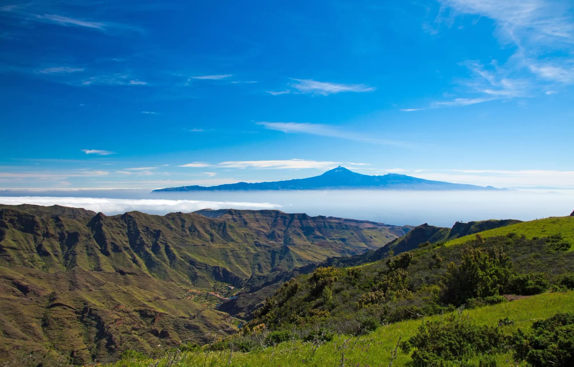
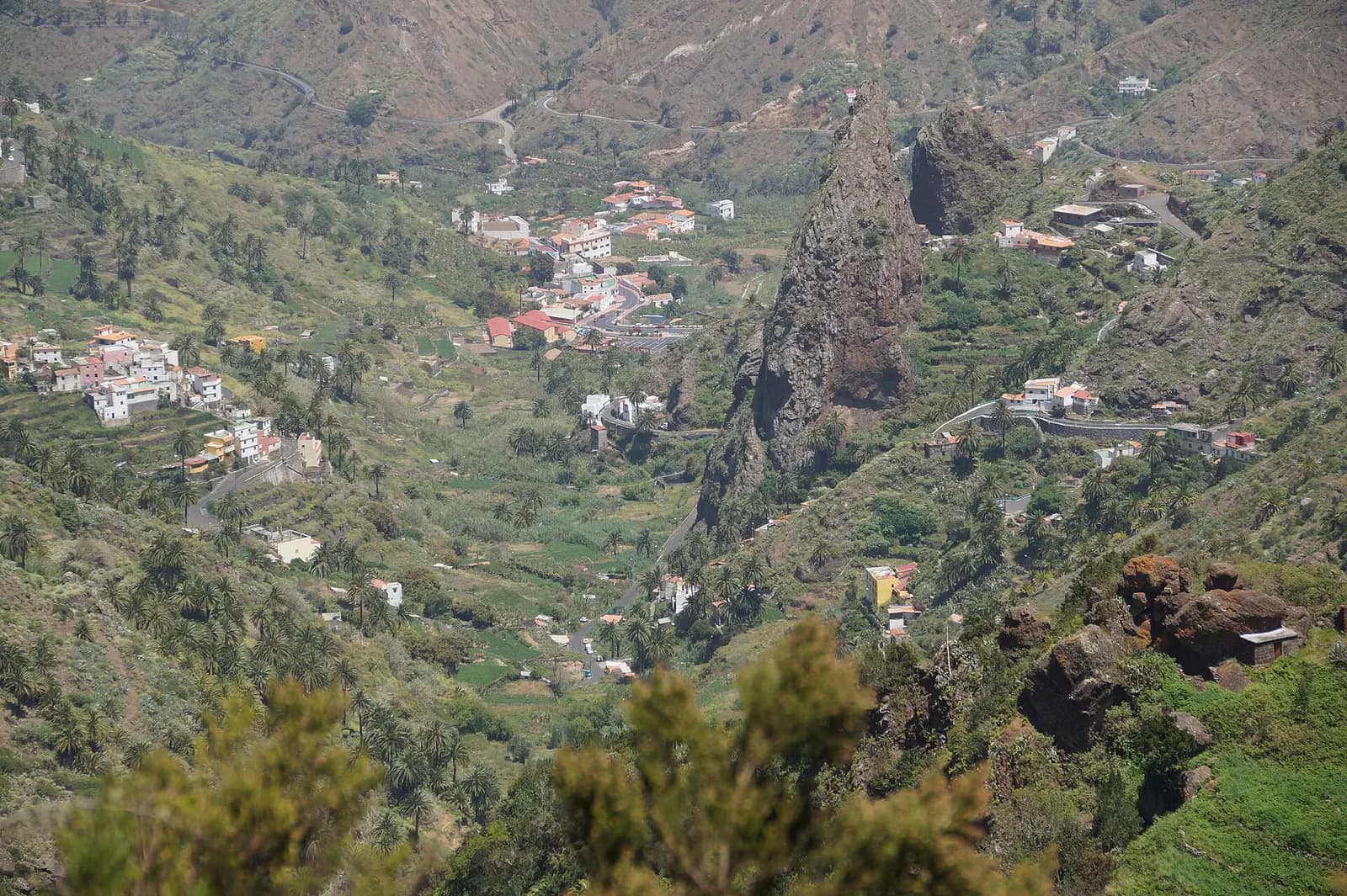
La Gomera is small and round, 370 square kilometres rising to 1,487 metres at the Alto de Garajonay. It came out of the ocean about 11 million years ago, and long quiet periods since have left erosion to do the work: a ring of deep ravines runs down from the summit in every direction, which the park compares to a giant lemon squeezer. Along the GM-2 road, the volcanic necks of Los Roques stand out where erosion stripped away the softer rock around them.
The forest lives on fog. UNESCO calls the fogs vital, the source of the moisture that keeps a lush forest alive on an otherwise dry island, and says the park is an important source of water for La Gomera, with the best preserved network of permanently flowing streams in the Canary Islands. Below the forest, the streams run down the ravines towards terraced valleys such as Hermigua, on the wetter north side of the island.
The animals are mostly small and odd. According to the park, Garajonay holds 13.6 endemic animal species per square kilometre and around 1,000 animal species in all. Bats are the only native mammals. The giant earwig of La Gomera, 4 centimetres long, is the second largest earwig in the world, lives only in the park and is one of the few insects that looks after its young. On the forest floor lives a beetle that, when disturbed, gives off a strong smell of rotten cheese.
Sugar, goats and fire
The forest that walkers see is not untouched. The park's history page tells it plainly. At the end of the 15th century the sugar mills arrived, and they burned enormous amounts of firewood, some of it even shipped to the mills of Gran Canaria. UNESCO says forest cover on La Gomera fell by some 65% in little more than a century after the European conquest. The wood of the barbusano, dark enough to be called the ebony of the Canaries, went into furniture, ships and houses. In hungry years people made cakes from the roots of the common fern. Livestock grazed in the forest until the 1940s.
What saved the rest was, in part, feudalism. From the middle of the 15th century until the first third of the 19th, the counts of La Gomera owned the land and the water, and their strict rules on using the forest spared it the damage done on other islands. In the 1960s pressure eased further, with bottled gas replacing firewood and charcoal and with emigration to Venezuela and Tenerife. At the same time, pine was planted in several parts of the island, including hundreds of hectares in the south of what is now the park. The Swedish botanist Eric Sventenius and the brothers Buenaventura and Telesforo Bravo pressed for protection, and the Spanish parliament declared the national park on 25 March 1981.
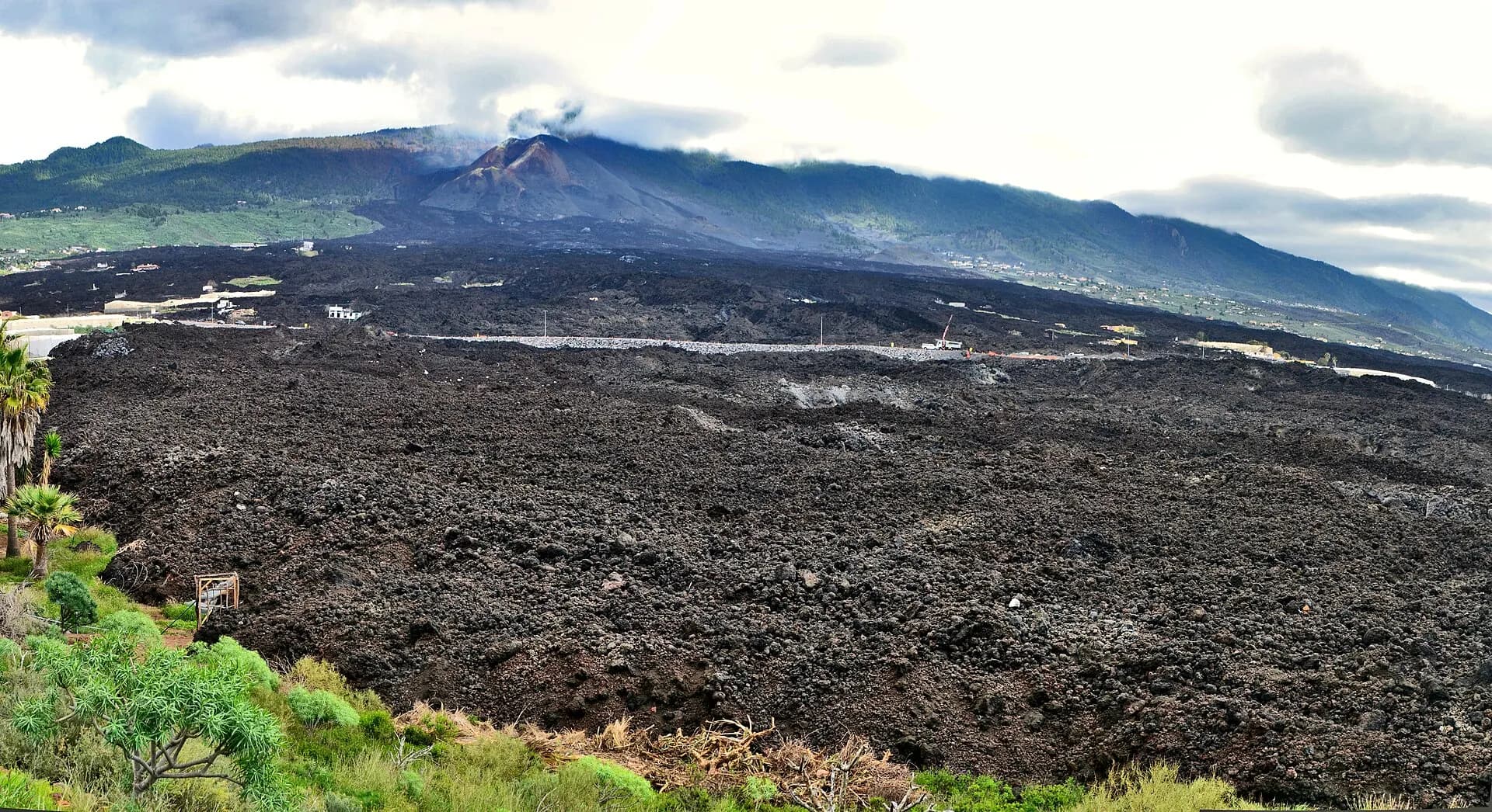
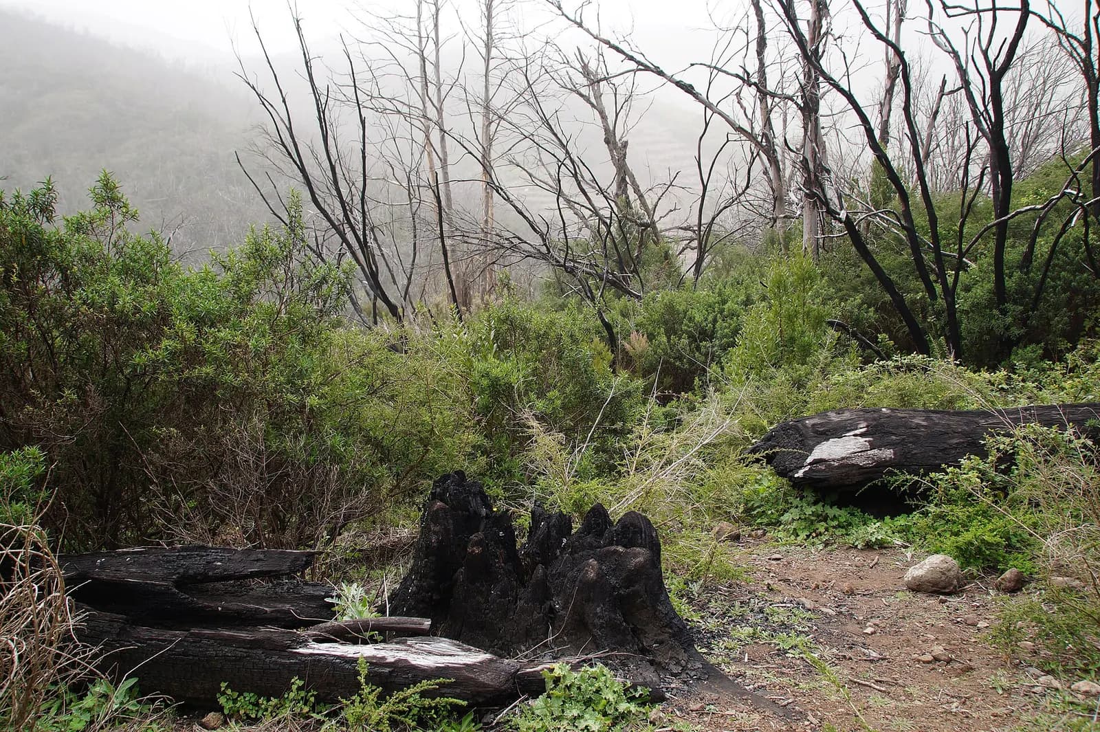
Fire is the great threat. In 1984 the fire of Los Roques killed 20 people, and in 2012 a fire swept through 20% of Garajonay. The park has restored more than 500 hectares damaged by fires, felling and past forestry, and says plainly that whether those areas recover will depend on there being no more fires, and on rain.
The altar on the summit
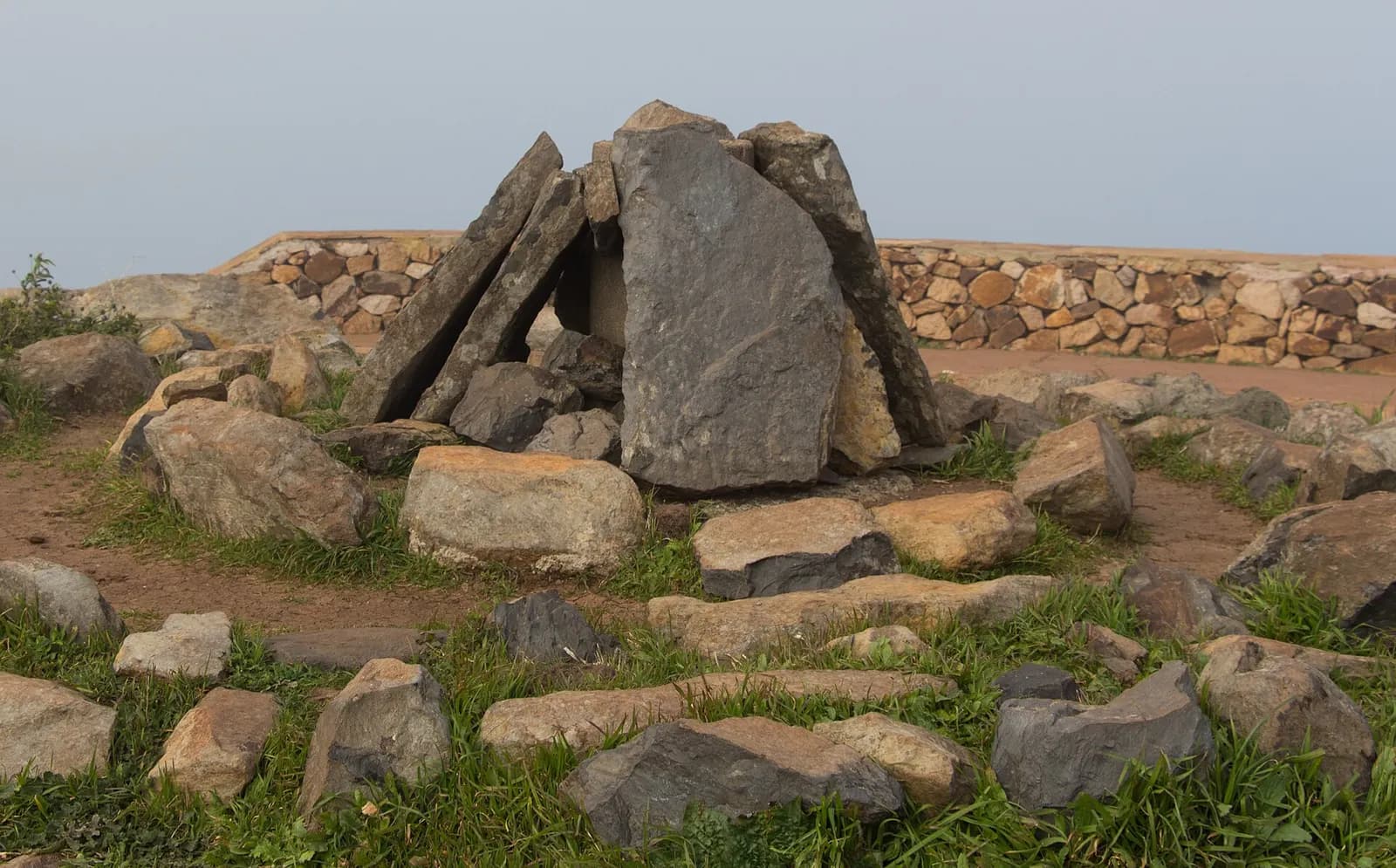
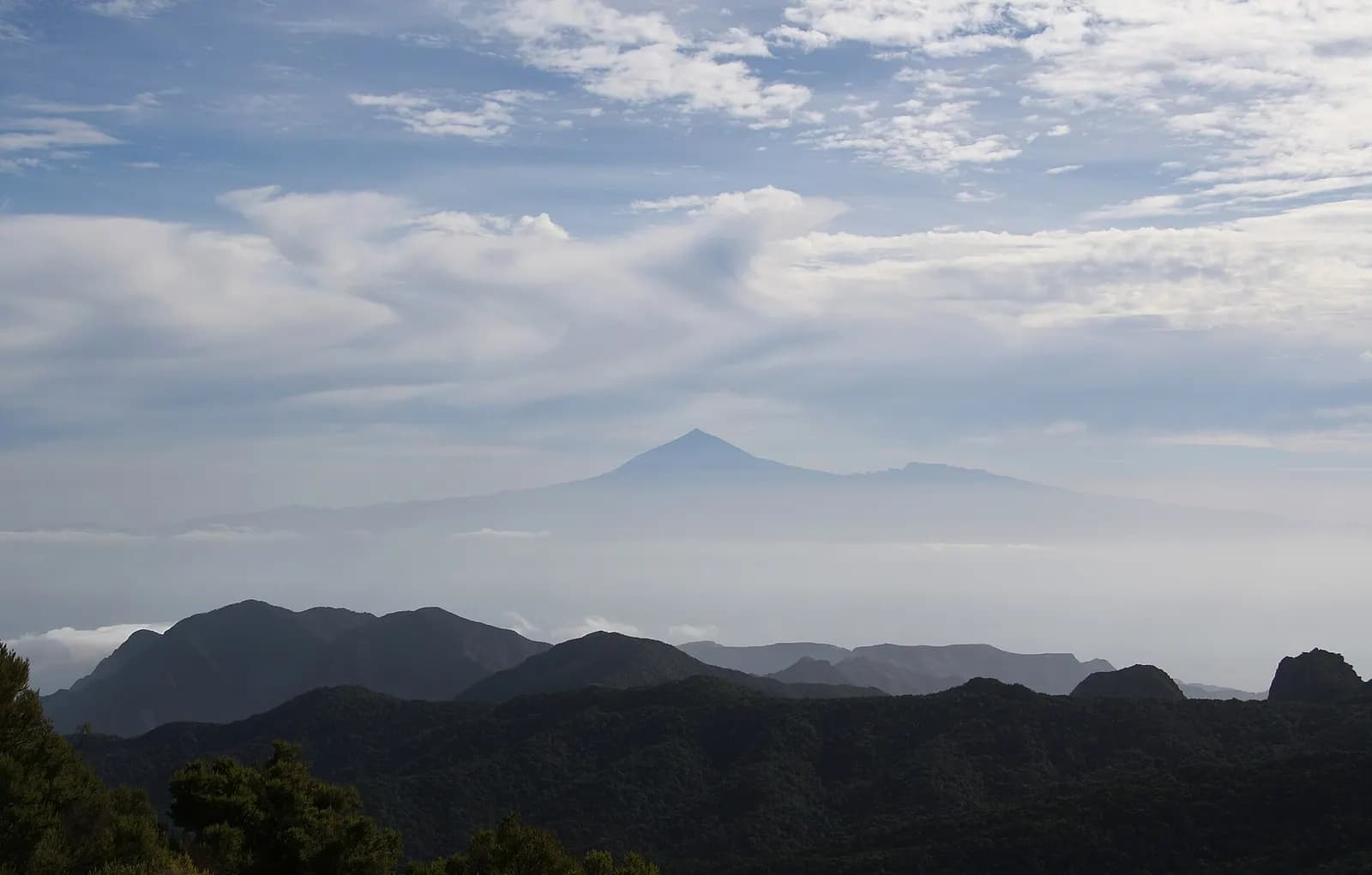
The Alto de Garajonay, the highest point of La Gomera, is a short climb from the road, and the park says Garajonay is the only national park with an archaeological site on its highest summit. Stones of every size, some of them huge, formed altars where the island's first people made offerings to their god, burning the parts of goats and sheep that could not be eaten. The god was the sun, Orahan, and the park describes the sunrises from the top, with the sun coming up behind Teide, on Tenerife.
Telesforo Bravo, the geologist who helped save this forest, also gave his name to the last stretch of path on Teide, the one that needs a permit. How to get up there is in climbing Mount Teide. From the Alto, it is the view.
Walking in Garajonay: routes, centres and rules
The park's route network has 18 waymarked walks. The shortest are strolls of under a kilometre around La Laguna Grande and Los Barranquillos. The summit is not much harder: route 7, from Contadero up to the Alto de Garajonay and back, is a circle of 2.5 kilometres that the park puts at an hour and rates as easy. Route 9 drops from Contadero into the forest of El Cedro and climbs back out: 9.6 kilometres, two and a half hours, medium difficulty. The longest is route 18, the great circle from Pajarito through El Cedro and Tajaqué: six and a half hours, rated hard, and between 12.7 and 15.4 kilometres, as the park's own pages disagree. The park also runs guided walks in small groups, booked on the national parks' booking site, and gives out audio guides for some routes at its two centres: the Juego de Bolas visitor centre, near Agulo, and the information centre at La Laguna Grande, in the middle of the park.
For longer walks the island's own network has more than 600 kilometres of paths, according to the island's tourism office. The GR 131 follows the spine of La Gomera and crosses the Alto de Garajonay, and the GR 132 goes all the way round the coast from San Sebastián. The tourism office calls both demanding, with constant climbs and descents in and out of ravines. It is the right word.
The park's rules are short and worth reading before you go. Walk only on authorised roads and paths, and leave the reserve zones and any path that needs an authorisation to those who hold one: off the path, the park warns, it is very easy to get lost. No drones, kites, hang-gliders or fireworks. Dogs on a lead. Nothing is picked: what belongs to the forest stays in the forest. Fire is allowed only in the cooking areas at La Laguna Grande, in the periods set for it. Nobody may spend the night inside the park. Bicycles are allowed on roads and most forest tracks but never on the walking paths, and nobody should bathe in the streams, which are very cold and full of small creatures that do not need visitors. Climbing on the rocks and roques needs the park's express permission. Trails close for weather alerts and fire risk, so check the park's notices on the day.
Bring warm clothes and comfortable shoes, as the park advises, and expect wet paths. In 2025 the park received 1,365,199 visitors, according to the national parks network. A short way down the path to El Cedro, the forest is fog, water and very little noise.
Whistles across the ravines
Quiet is relative on La Gomera. Across the same ravines, people have long talked by whistling, in silbo gomero, a whistled form of Spanish. UNESCO, which listed it in 2009, says two whistles stand for the five vowels and four for the consonants, and that it has been taught in schools since 1999. On 30 September 2026, at the ceremony for the 17th anniversary of that listing, the Cabildo of La Gomera and the island's silbo association gave the national park an award, as one World Heritage site to another on the same small island. A delegation from Türkiye, which has a whistled language of its own, was in the room.
At the edge of the forest
Las Hayas, in Valle Gran Rey, sits right on the edge of the park. More than half a century ago Efigenia Borges opened a place to eat there whose cooking has always been vegetarian, and today her son Sergio Méndez runs Casa Efigenia and makes palm syrup, miel de palma, which we sell as Casa Efigenia palm syrup. How the palms are tapped is told in palm honey from La Gomera. From Alojera, on the north-west coast, comes the family behind El Masapé, who make the island's cheese spread, almogrote, in their kitchen on Tenerife. The rest of the island is in our guide to La Gomera.
Verneau was half right. The forest survived, but not out of respect alone. For nearly four centuries it belonged to the counts of La Gomera, and they were stingy with it.
Questions
- Do you need a permit for walking in Garajonay?
- Not for the 18 waymarked routes of Garajonay National Park, which are open to walkers who stay on them. The park's reserve zones, and any path that needs an authorisation, are closed to anyone without one. Guided walks in small groups are booked on the Spanish national parks' booking site, reservasparquesnacionales.es.
- How long does it take to walk to the top of Garajonay?
- Route 7, from Contadero to the Alto de Garajonay (1,487 m) and back, is a circle of 2.5 kilometres that the park puts at about an hour and rates as easy. Route 17, from Pajarito to the summit of Garajonay and back, takes about an hour and a quarter and is rated medium.
- What is the longest walk in Garajonay National Park?
- Within Garajonay National Park, route 18, the great circle from Pajarito through El Cedro and Tajaqué, takes about six and a half hours and is rated hard; the park gives its length as 12.7 kilometres on one page and 15.4 on another. For several days, the GR 131 follows the spine of La Gomera across the summit, and the GR 132 goes round the island's coast.
- Can you camp or stay overnight in Garajonay?
- No. The rules of Garajonay National Park do not allow anyone to spend the night inside the park. Fire is allowed only in the cooking areas at La Laguna Grande, in the periods set for it.
- What happened in the 2012 fire in Garajonay?
- In 2012 a fire swept through 20% of Garajonay National Park. The park has restored more than 500 hectares damaged by fires, felling and past forestry, and says their recovery will depend on there being no more fires, and on rain. In 1984 the fire of Los Roques killed 20 people.
- What should you take for walking in Garajonay?
- Warm clothes and comfortable shoes, as the park advises, because the summit plateau of Garajonay is often in fog and the paths are wet. Trails can close for weather alerts and fire risk, so check the park's notices on the day.