Carros de Foc: the refuge loop of Aigüestortes, Catalonia's national park
Aigüestortes, Boí and Espot, Lleida//Activities/9 min read
Nine refuges, more than 200 lakes and little phone signal: how a park declared after a tour of power stations became a hut-to-hut walk, and how to book it.
 Written with by Eduardo Peire
Carros de Foc is a circular high-mountain walk of about 65 kilometres that links the nine staffed refuges of the Aigüestortes i Estany de Sant Maurici National Park, in the Pyrenees of Lleida. Most walkers take five to seven days and can start at any refuge, in either direction. The highest point is the Coll de Contraix, at 2,745 metres, and the refuges sit between 1,900 and 2,400 metres. It is not waymarked as a single trail, most of it has no phone coverage, and camping is forbidden, so the nights have to be booked in advance through one central reservation office. The name means Chariots of Fire. Nobody seems quite sure why.
The park it circles is the only national park in Catalonia, and it was declared a month after a dictator's tour of the power stations around it.
A park declared after a tour of power stations
At the end of September 1955, General Franco travelled through the Pyrenees to open hydroelectric power stations. According to the park's own history, he spent a night at La Farga, in the Vall de Boí, and crossed the pass of El Portarró on his way to Espot. A month later, on 21 October 1955, Aigüestortes i Estany de Sant Maurici was declared a national park under a law of 1916. It covered only 9,851 hectares and was the fifth national park in Spain and the second in the Pyrenees, after Ordesa.
The park's history page is candid about what that first park was. Most of the land was privately owned, logging carried on as a business until 1975, and the power stations kept working under their concessions. On the 70th anniversary in 2025, the Catalan public broadcaster 3Cat put the point of it more bluntly: the declaration served to stop new dams. The park's director, Lluís Florit, told it that without that protection "we would be talking about a valley full of reservoirs".
Real protection came later. A Catalan law of 1988 reclassified the park, and a decree of 1996 extended it to 14,119 hectares of park proper, with only 231 left in private hands, plus 26,733 hectares of peripheral zone around it. Together that makes 40,852 hectares, from a low point of 1,200 metres to the summit of Comaloforno at 3,029.
Twisted waters and the enchanted peaks
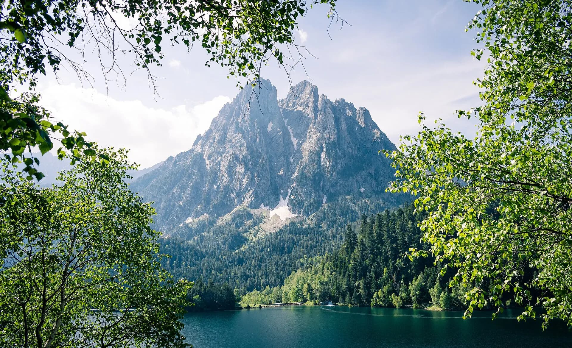
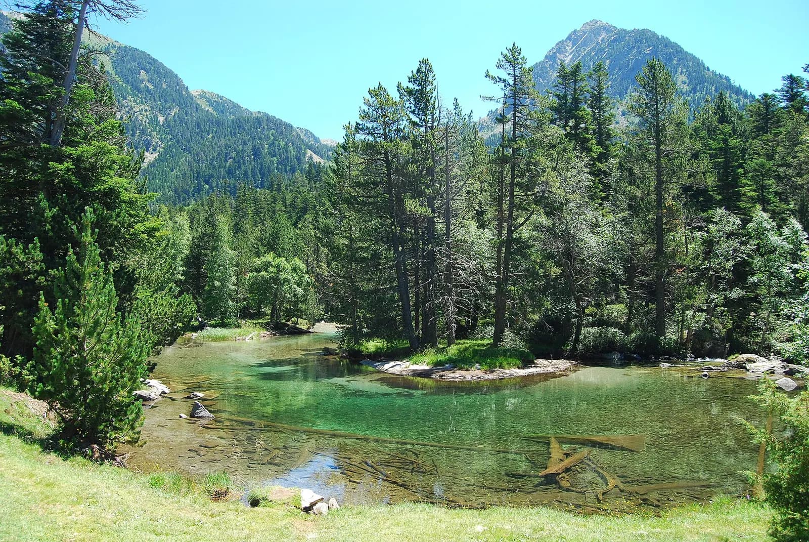
Aigüestortes means twisted waters, and the name describes the meadow at the western end of the park, where streams wander through grass and pines on a flat valley floor. At the eastern end is the Estany de Sant Maurici, a lake under the two rock towers of Els Encantats, the enchanted ones, which are on the park's logo. They are limestone changed by heat and pressure, an island of it in the largest granite lake district of the Pyrenees.
Between the two lie the lakes. The park counts more than 200, of which about 150 are real lakes and the rest pools that can dry out by late summer, and it calls this the highest density of lakes anywhere in the Pyrenees. Bearded vultures, golden eagles and griffon vultures work the bare ridges above them.
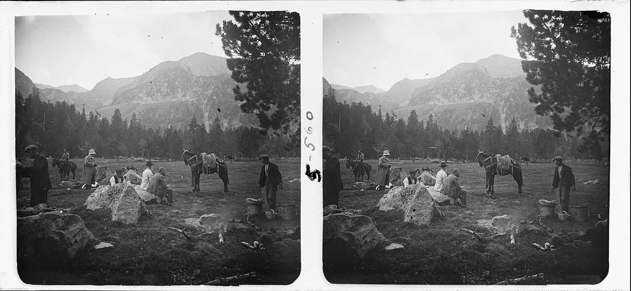
People came here long before the park. In 1920 the doctor and photographer Josep Salvany i Blanch took a stereo picture of a lunch in the meadow of Aigüestortes, with saddled pack animals standing among the picnickers, 35 years before anyone declared the place worth protecting.
How Carros de Foc began
The walk was not designed by a tourism board. According to a 2020 article in the Spanish trail-running press, it began in the summer of 1987, when some of the refuge keepers spontaneously decided to go round the park in a single day, meaning only to pay a courtesy visit to the other refuges. More visits followed, and the name turned up the same way. Even the keepers, the article says, do not explain exactly why it was chosen or who thought of it.
The fast version still exists. In 2020 the runner Andreu Simón went round in 9 hours 22 minutes and 36 seconds, five minutes faster than a record that had stood for eleven years. Almost everyone else walks it in five to seven days, sleeping in a different refuge each night.
The official route page gives the loop as 65 kilometres with 9,200 metres of total elevation change, and the organisers list the nine refuges: Amitges, Ernest Mallafré and Josep Maria Blanc on the Espot side; Saboredo, Colomèrs and Restanca towards the Val d'Aran; Ventosa i Calvell and Estany Llong in the Vall de Boí; and Colomina above the Vall Fosca. A longer and harder variant, Carros de Foc Plus, adds Pla de la Font and Gerdar. Walkers carry a pass card that is stamped at each refuge.
Granite, cairns and no signal
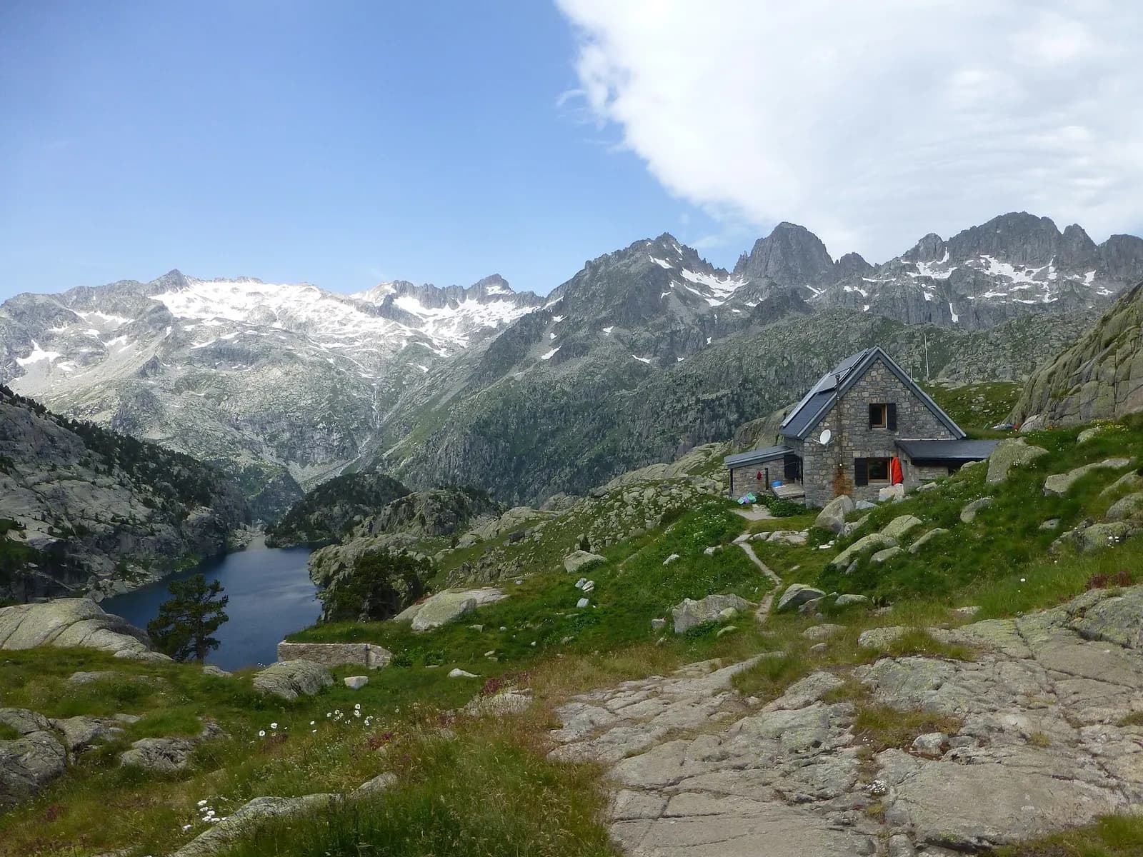
The organisers are honest about the ground. The whole crossing runs through high-mountain terrain of granite blocks, rockfalls and paths that change from stage to stage. There is no special waymarking. Some stretches share the GR 11 and its red and white marks, others have yellow wooden posts, and much of the time the line is kept by cairns left by earlier walkers. A map is described as an essential requirement, and some experience of high-mountain walking as necessary. In bad weather, they write, it can get really complicated.
The phone will not help much. The organisers say that 60 to 70 per cent of the route has no coverage, and the park warns that in an emergency walkers often will not be able to call 112, Spain's emergency number. Since 2025 the park has rented satellite messengers at its offices in Espot and Boí, so that walkers can call for help from places with no mobile network, and every staffed refuge has an emergency button connected by radio to the Catalan fire and rescue service. 3Cat put the number of rescues in the park at more than a hundred a year.
The rule that shapes the whole walk is simple. Wild camping is forbidden throughout the national park, and the organisers say the park rules out bivouacs on the crossing too. So the beds decide the itinerary, not the other way round.
Sant Climent de Taüll and the Vall de Boí
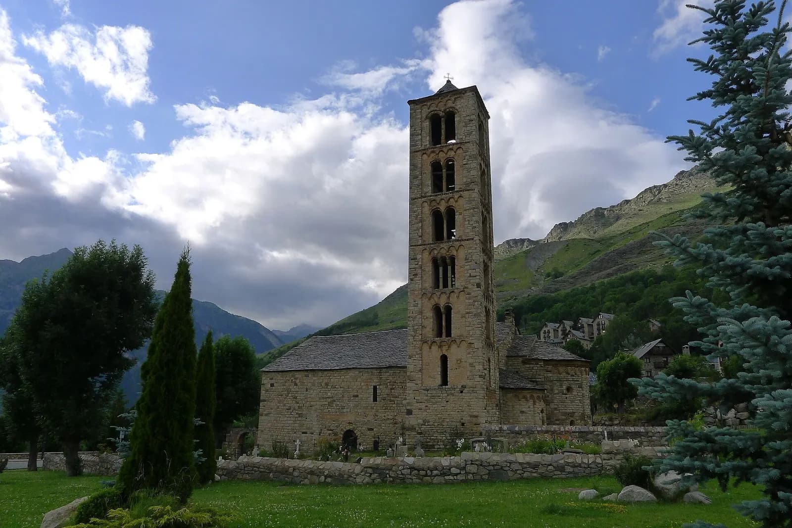
The Boí side of the loop ends in a valley with another listing. The Catalan Romanesque churches of the Vall de Boí have been a World Heritage site since 2000: eight churches and a hermitage built in the 11th and 12th centuries in the villages of the valley, under the patronage of the lords of Erill. Sant Climent de Taüll, consecrated in 1123, is the best known, because the painting in its apse, a Christ in majesty, was removed from the walls about a century ago and taken to Barcelona, where it is in the Museu Nacional d'Art de Catalunya.
What the church has now is light. A video mapping projects the original painting back onto the apse as it would have looked in 1123. Plan around one detail: the Romanesque centre of the Vall de Boí announces that work on the church roof begins on 30 November and is expected to last until the end of spring 2027, and that the church will be closed to the public meanwhile.
Old forests, shorter winters and a bigger park
Seventy years after the logging stopped, the forests have started to make the case for the park. In October 2026 the park published a study by the research centres CREAF and CTFC that found the greatest amount and quality of mature forest known so far in Catalonia and Spain. The 20 most mature stands cover 432 hectares, mostly silver fir, and score up to 8.7 out of 10 on the study's maturity index, against 2.3 for the forests of Catalonia as a whole. In fir plots, the carbon held in living trees rose from 69.8 to 148.5 tonnes per hectare between the 1993 inventory and the latest one.
The climate is moving the other way. 3Cat reported that, over the last two decades, the park's long-term monitoring shows the period of permanent snow eight days shorter on average and a mean temperature 1.3 degrees higher. The park receives about 600,000 visitors a year, with an estimated direct impact of 17 million euros, and a new plan for its use and management is being prepared.
And it may grow. On 13 October 2026 the Catalan government gave initial approval to extend the park by 2,259.10 hectares, taken from its peripheral zone in La Torre de Capdella and Sort, and to add 3,577.43 hectares of new peripheral zone. By the government's current measurements, that takes the protected area from just under 40,000 hectares to 43,572.78. All the land is public and the town halls agree. The proposal still has to be approved jointly with the Spanish ministry and go through public consultation.
Carros de Foc: when to go, how to book and how to get there
The park is open all year, but it warns that it is covered in snow for much of it, and that in spring there are always icy snowfields where crampons may be needed. Each refuge publishes its own staffed season, and the beds are what make the walk possible.
Booking is the first step. The crossing with a pass card can only be done with reservations made in advance through the Carros de Foc central reservation office, and the organisers advise booking well ahead, particularly for summer. Each night is secured with an advance payment per person, which is then taken off the bill at the refuge. The refuge holds the place until 19:00 on the day of arrival. Cancelling more than 15 days ahead loses 25 per cent of that payment, between 15 and 7 days ahead 50 per cent, and inside 7 days all of it. Dates and refuges cannot be swapped.
The refuges are not hotels. Most run on solar power, so a hair dryer is out of the question, not all of them have hot water, most do not take cards, and only some can take rubbish, so what goes up in a rucksack comes down in it. Dogs must be on a lead throughout the park.
Getting to the start takes planning, because private cars are restricted inside the park. The park's access page lists car parks at Prat de Pierró, above Espot, and La Molina, on the Boí side, both barred to vehicles wider than two metres and both closed when full; Prat de Pierró is closed from 1 December until Easter. From Boí and Espot, 4x4 taxis run up to Aigüestortes and Sant Maurici all year, weather permitting. From June to September a park bus links Boí and Espot twice a day through the Val d'Aran, which is useful for walkers who finish far from their car. In 2026, from 4 to 23 August, access to the Ribera de Caldes area was regulated with an electric bus from the La Farga car park, and the access page is the place to see whether that returns.
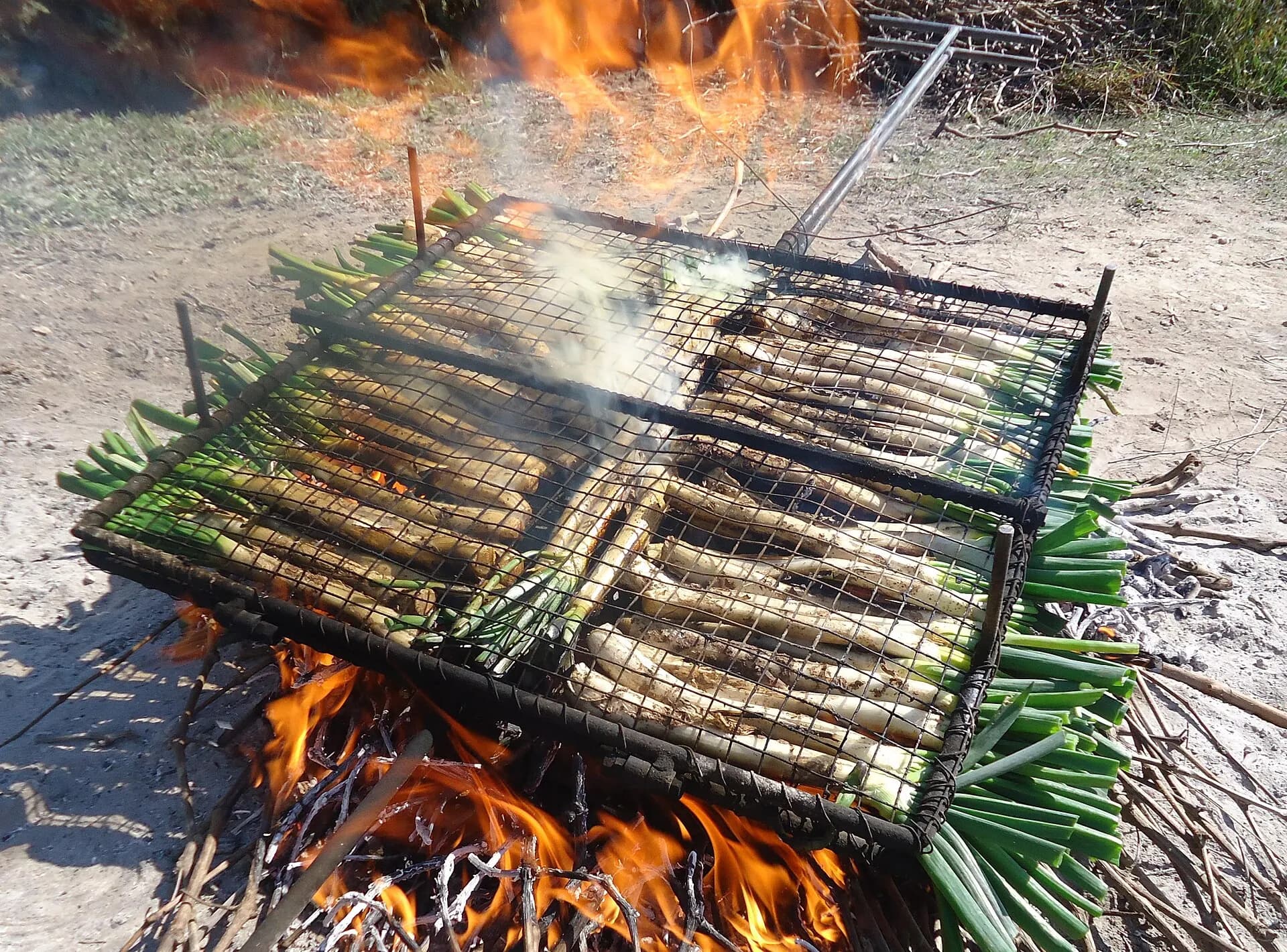
The rest of Lleida, and of Catalonia, can wait for the walk down. Out of the walking season, the calçotada of Valls, held on the last Sunday of January further south, is another reason to come back, and Ordesa, the older park, lies further west in the Pyrenees of Aragon.
Els Encantats end up on almost every camera that passes the Estany de Sant Maurici. The lake under them, like every lake in the park, is closed to swimmers.
Questions
- How long does Carros de Foc take?
- The organisers give five to seven days for the basic loop of about 65 kilometres, starting at any of the nine refuges and walking in either direction. The highest point is the Coll de Contraix, at 2,745 metres, and the refuges sit between 1,900 and 2,400 metres. The runner Andreu Simón went round in one go in 9 hours 22 minutes and 36 seconds in 2020, which is not a plan for anyone else.
- Do you need to book the Carros de Foc refuges?
- Yes. The crossing with a pass card can only be done with reservations made in advance through the Carros de Foc central reservation office, ideally well ahead for summer. Each night is secured with an advance payment per person, taken off the bill at the refuge. Cancelling more than 15 days ahead loses 25 per cent of it, between 15 and 7 days 50 per cent, and inside 7 days all of it.
- Can you camp or bivouac on Carros de Foc?
- No. Wild camping is forbidden throughout the Aigüestortes i Estany de Sant Maurici National Park, and the Carros de Foc organisers say the park rules out bivouacs on the crossing too. The refuges are the place to sleep on the loop, which is why the bookings decide the itinerary.
- Is Carros de Foc waymarked?
- Not as a single trail. Some stretches follow the GR 11 and its red and white marks, others have yellow wooden posts, and much of the line is kept by cairns over granite blocks and rockfalls. The organisers call a map an essential requirement and say some experience of high-mountain walking is necessary. In bad weather the route can become serious.
- Is there phone coverage on Carros de Foc?
- Mostly not. The Carros de Foc organisers say 60 to 70 per cent of the route has no coverage, and the park warns that walkers often cannot call 112 in an emergency. Since 2025 the park has rented satellite messengers at its offices in Espot and Boí, and the staffed refuges have emergency buttons connected by radio to the Catalan fire and rescue service.
- How do you get to Aigüestortes without a car?
- Private cars are restricted inside the park. From Boí and Espot, 4x4 taxis run to Aigüestortes and the Estany de Sant Maurici all year, weather permitting. From June to September a park bus links Boí and Espot twice a day through the Val d'Aran, without pets or bicycles. In summer there is also transport towards the Colomèrs and Restanca refuges from the Val d'Aran.